The End
Well, that’s it! A lot of things have happened since completing Te Araroa. Not even three weeks ago I was walking my last trail section to Invercargill. Afterwards we started a road trip around the South Island, walked the Kepler track, kayaked in Doubtful Sound. And now (28.03.2020) we are in lockdown level 4 waiting to be able to leave the country with a flight out of Christchurch. But that’s a different story.
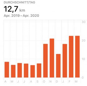
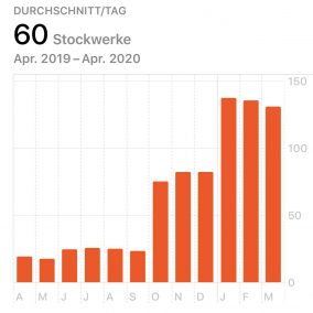
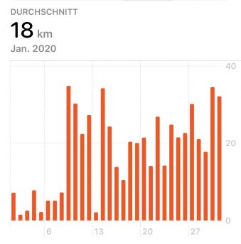
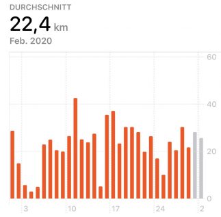
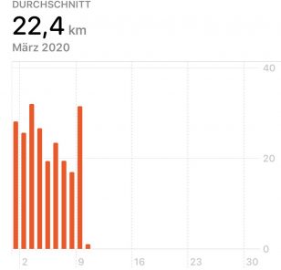
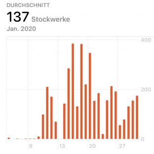
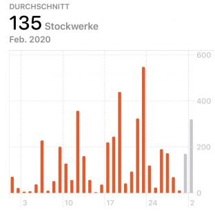
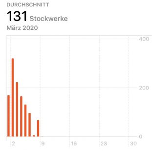
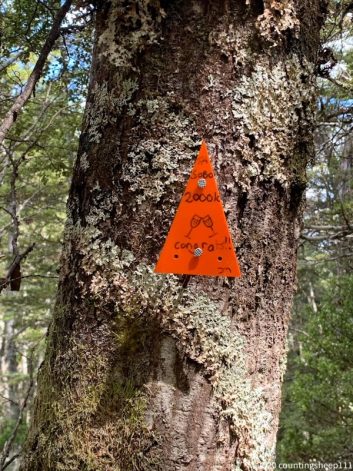
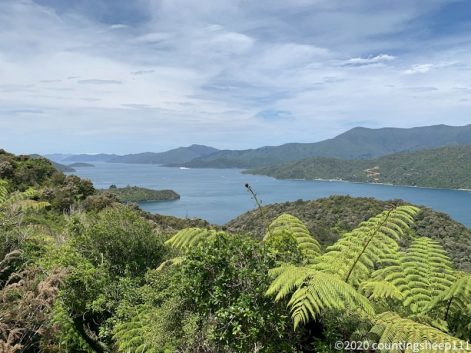
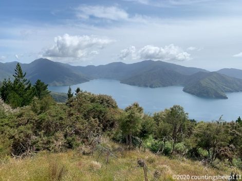
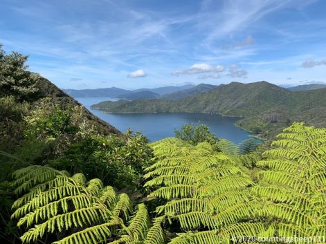
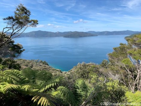
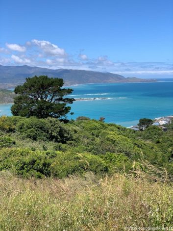
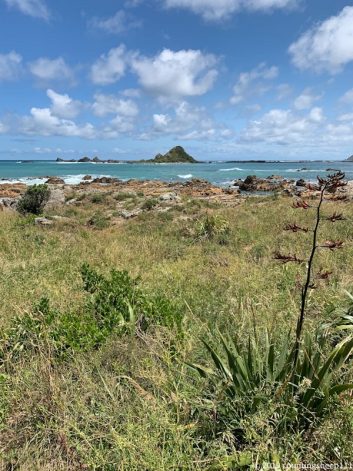
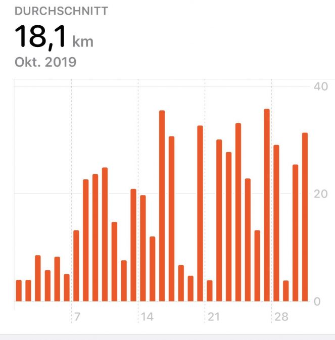
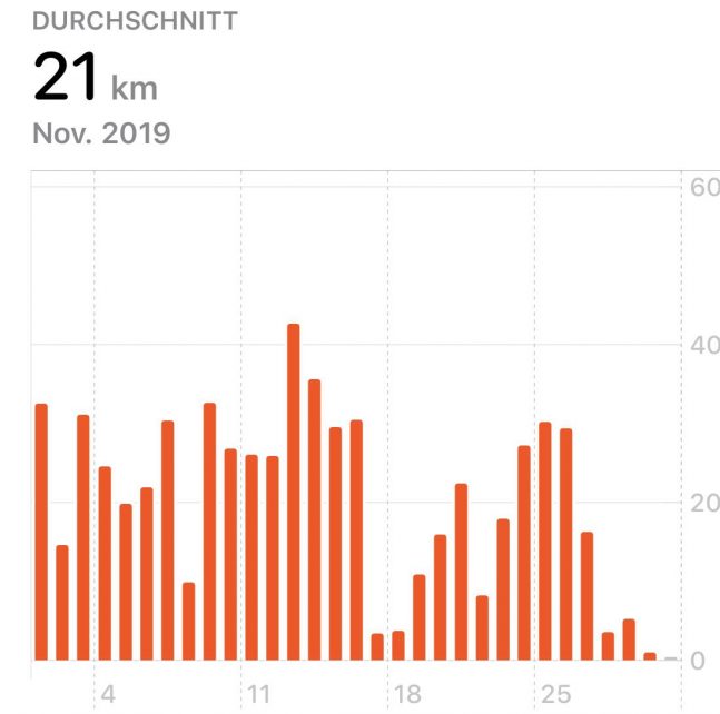
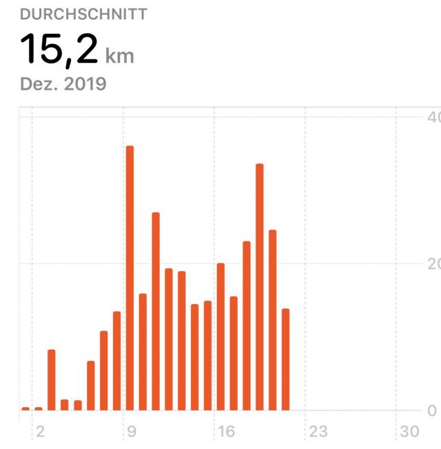
Over the last five and a half months I have spent 111 days walking through some of the most beautiful parts of New Zealand. I have walked about 2200km on Te Araroa and also many kilometers off trail to reach accommodations, get resupplies, or catch a ride. Plus some kilometers biking, kayaking, and canoeing. Overall a very active time as the statistics below illustrate ;). The kilometers per day were not much of a difference between North and South Island. However, the average ascent and descent has about doubled. Starting with the Queen Charlotte Track there were only very few days without ascending or descending a couple of hundred meters. But this has been rewarded with just one amazing view after another. I’m currently still in the phase of realizing what I have just accomplished and do not miss walking yet. But I guess this will change sometime soon. And probably I will wish for being out there in the backcountry again climbing up mountains.
Over the next months I will be busy sorting photos and compiling some sort of photo book. I will revisit every day of my journey and by this enjoy it a second time. Well, for some sections this actually might be the first time of really enjoying it ;).
Statistics South Island
As I have done for the North Island, I did some statistics on walking the South Island: according to the official map, it is 1310km from Ship Cove to Bluff. Out of those, I have walked 1086km and biked 55km. The remaining 169km I have hitchhiked or taken alternative routes.
That’s the details:
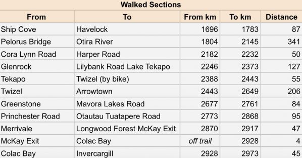
I got through the South Island with only one pair of shoes (but the sole is about to fall apart). I have thrown out three pairs of socks. Two squeeze bottles of my water filter broke. Two bite valves of my drinking bladder broke. And I have lost my 1.5ltrs Nalgene bottle somewhere after Pelorus Bridge. So overall not too many issues with my gear :).
Here are also some more statistics on covered distances and elevation:
16.03.2020 – Bluff
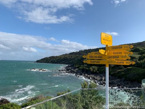
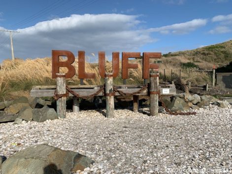
Today we have visited Bluff, the southern terminus of Te Araroa. This officially concludes my adventure of walking the length of New Zealand :). I’m pretty happy that we drove to Bluff as it is not really a nice stretch for walking. I have signed into the book of walkers who completed TA. Unfortunately there was no medal available anymore, but that’s just a minor thing. I have thousands of pictures reminding me of this great journey. And it will take me a couple of months to sort them and make some sort of best of. Looking forward to it and to be reminded of all the different sections of the trail.
09.03.2020 – Trail Day 111
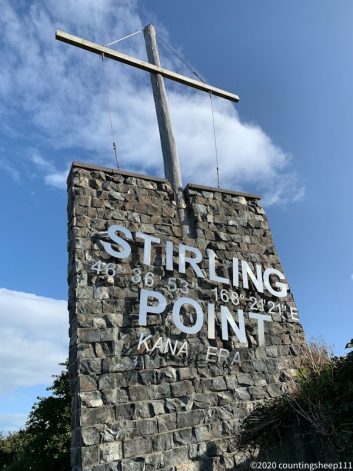
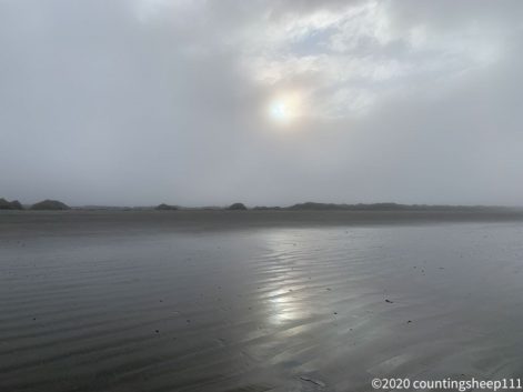
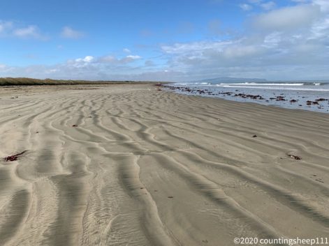
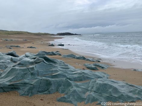
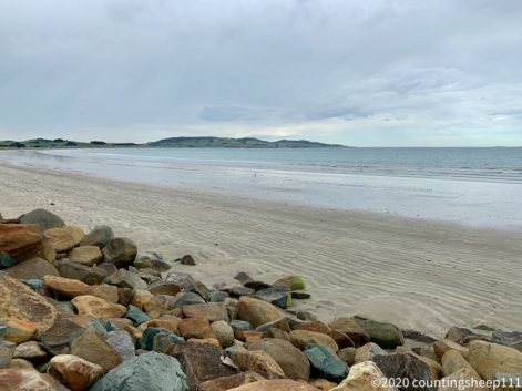
Today was my last day of walking Te Araroa. A 32km stretch from Riverton to Invercargill. First 20km on the beach and afterwards some walking along roads. We left pretty early as low tide was at 8am and we had to cross a river on the beach after 12km which should be done at low tide. We arrived at Invercargill around 2pm already and I felt really exhausted. And I’m quite happy that it is over now. The last weeks have been quite hard although the terrain was not too difficult. But I was barely motivated to walk. Maybe because it was not the most impressive scenery anymore. But now I’m there! Will visit Bluff in a couple of days for the obligatory pictures at Stirling Point though :).
08.03.2020 – Trail Day 110
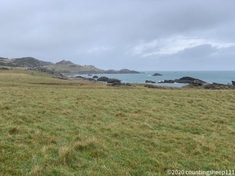
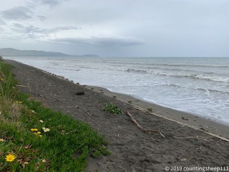
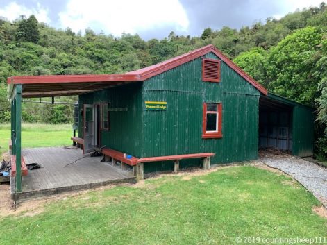
A nice walk in not so nice weather from Colac Bay to Riverton today. It was just 4hrs and 13km. The first part was beach walking before the track went up and down over cliffs for some kilometers. After a final climb to a viewpoint we descended into Riverton and grabbed a bed at Riverton Lodge. A combined backpackers and pub (again – somewhat like Otautau). As we arrived around noon there was plenty of time for a nice hot coffee and soup for lunch before shopping for some food for tomorrow’s walk. This will be the last section of TA for me; the final stretch to Bluff I will skip. Will go to Bluff by car as part of our upcoming South Island Road Trip.
07.03.2020 – Trail Day 109
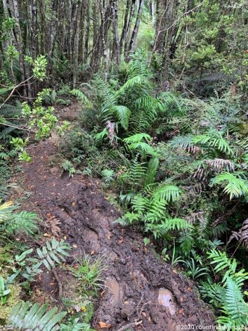
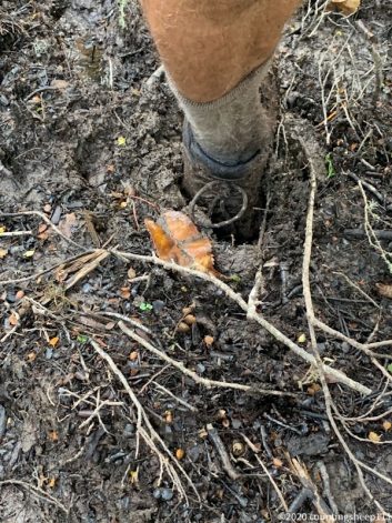
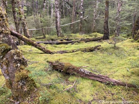
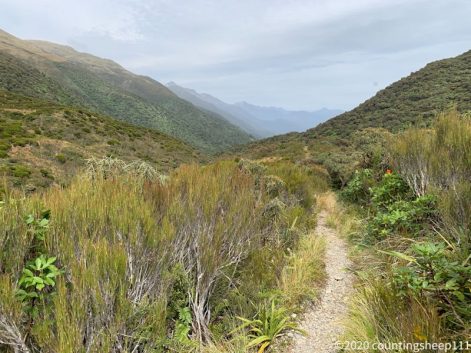
Today I reached Colac Bay after walking about 15km. This means I have arrived at the southern coast of the South Island. Feels pretty great looking at the map and seeing that I have walked the length of the country. Will probably take some time to fully realize this. And I have two more days of walking ahead towards Invercargill. The trail today was not too exciting. A pretty flat forest track with fallen trees and mud holes every couple of hundred meters. I took an early exit out of the forest and skipped some more mud walking. Arrived at Colac Bay already at 2.30pm. Staying at a dorm in the holiday park, this also means a nice hot shower available :).
06.03.2020 – Trail Day 108
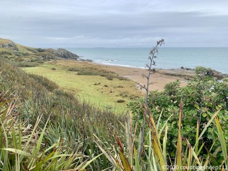
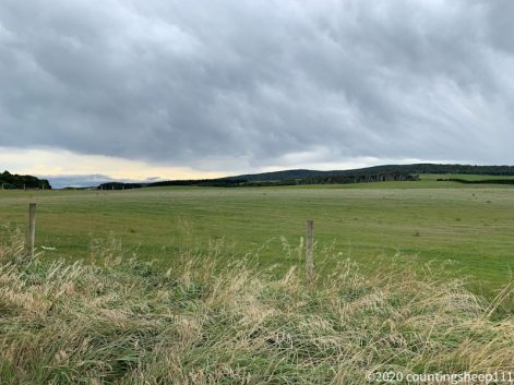
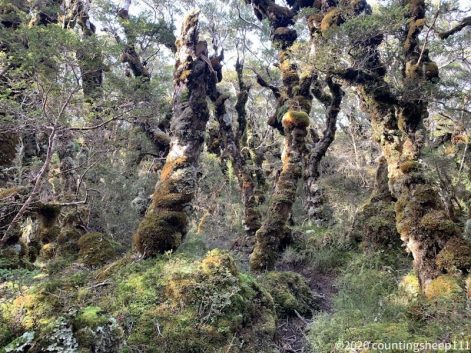
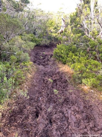
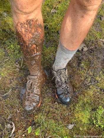
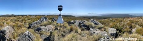
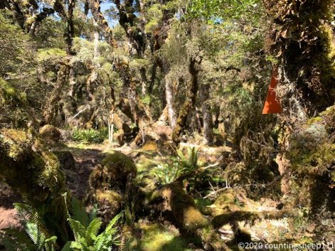
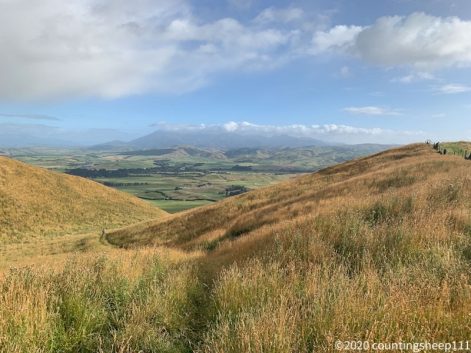
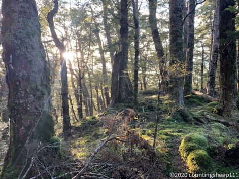
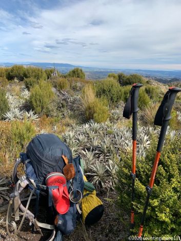
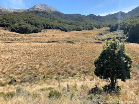
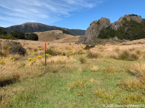
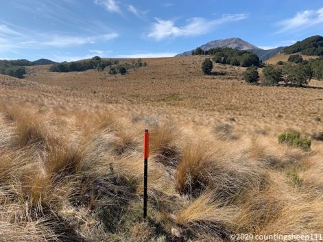
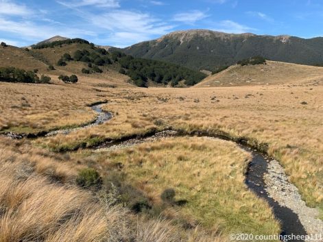
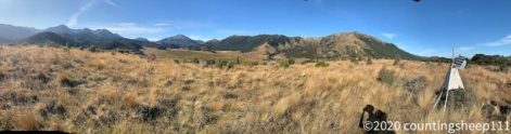
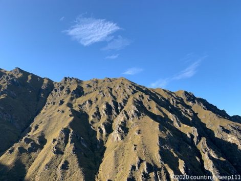
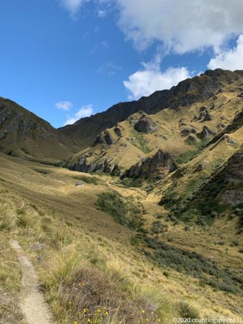
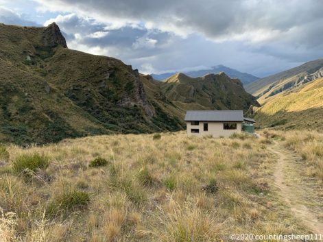
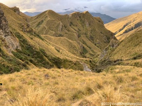
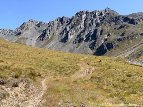
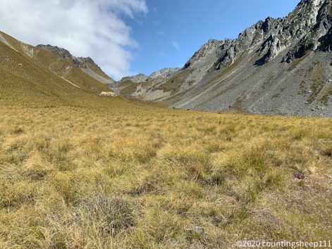
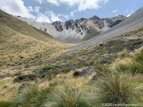
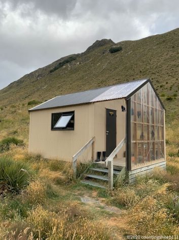
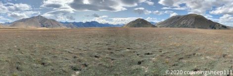
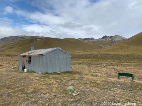
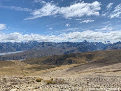
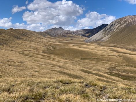
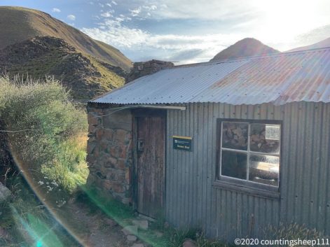
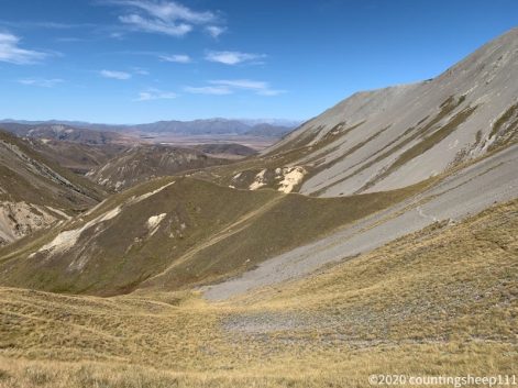
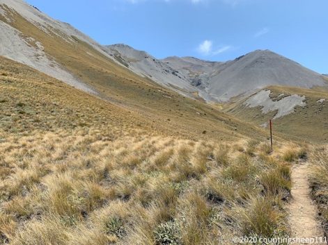
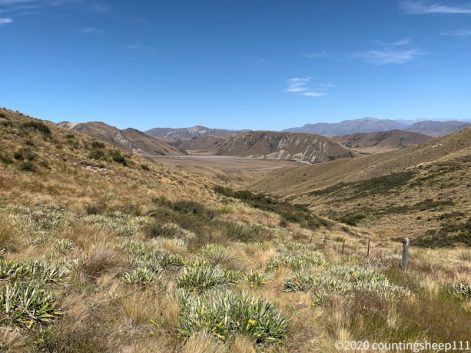
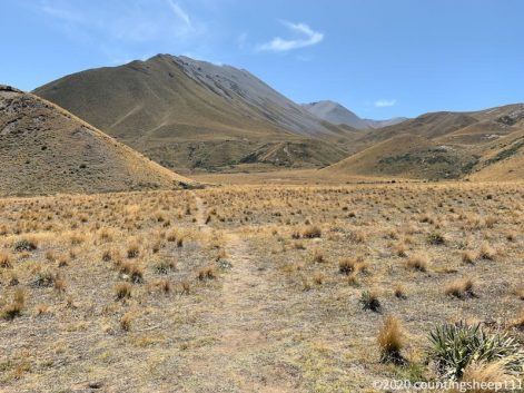
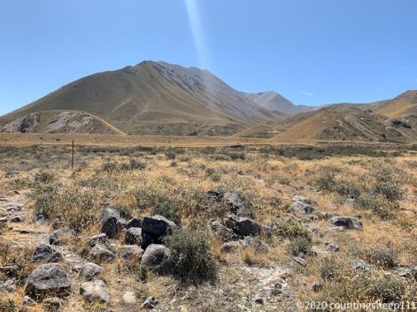
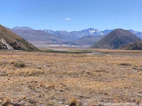
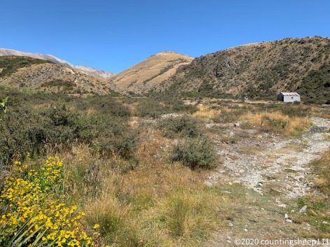
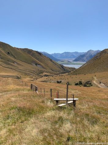
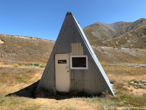
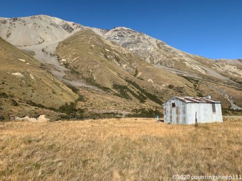
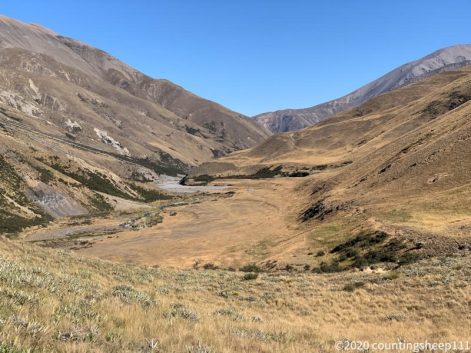
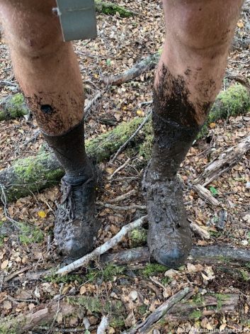
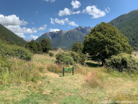
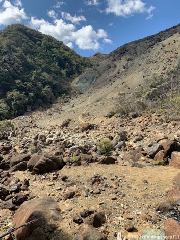
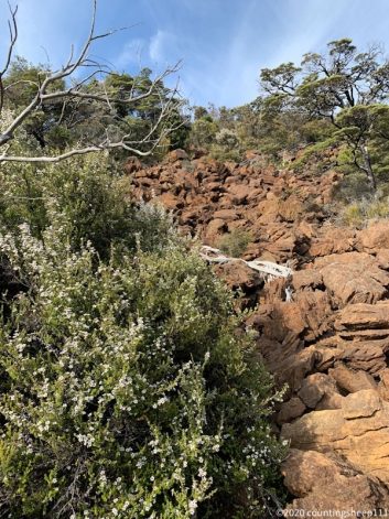
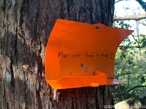
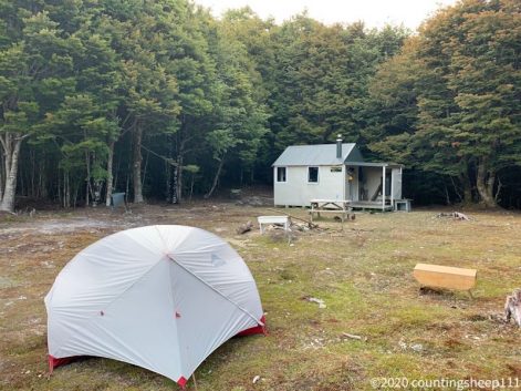
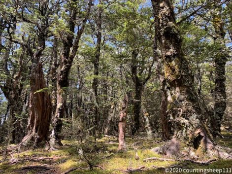
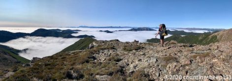
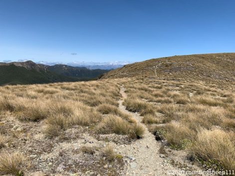
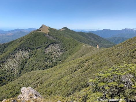
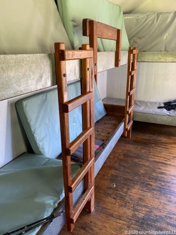
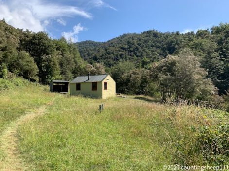
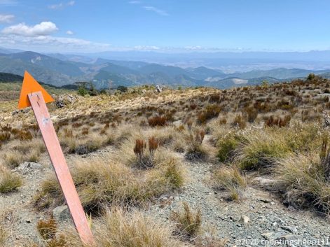
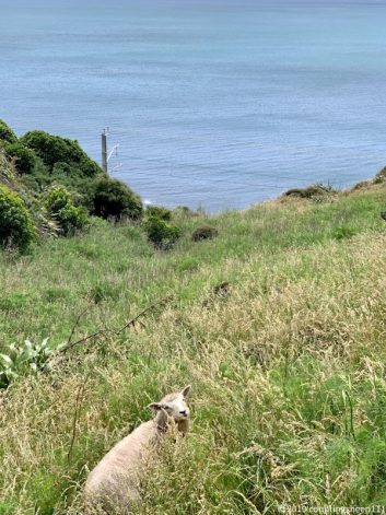
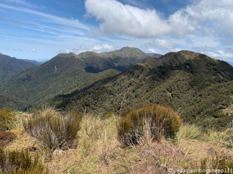
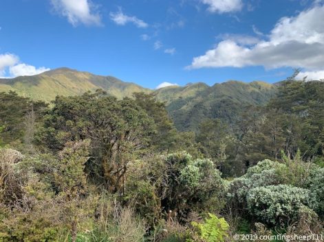
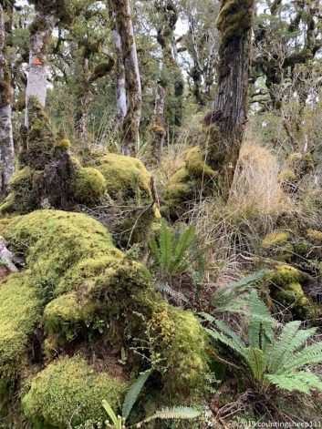
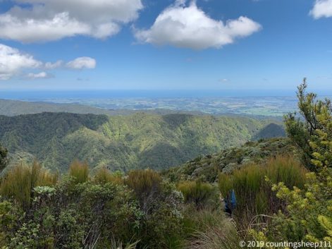
Today was 19km from one freedom camp spot to the next one. The day started with climbing up to Little Bald Hill; the last major ascent on TA. From there the trail continued along a ridge line for a couple of kilometers with nice views on beaches in the south and mountains in the north. The highest point along the ridge was Longwood with 764m. From there the trail went down to Martins Hut, quite old and I’m somewhat happy not to have slept there ;). I continued for another couple of kilometers along Ports Water Rave Track aiming for a camp spot next to some old mining machinery. This is in the middle of the forest and one of the rare flat spots for camping. Besides some nice views from the ridge line the forest is also beautiful. But also quite muddy in places. But have seen worse on the North Island in Ratea Forest. Nevertheless got trapped by the one or other mud hole. Luckily there was is stream shortly before where I’m camping so I could remove most mud before crawling in the tent.
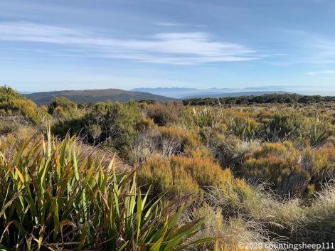
Bluff at the horizon
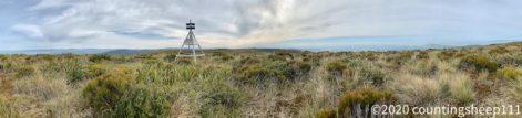
Longwood Summit
05.03.2020 – Trail Day 107
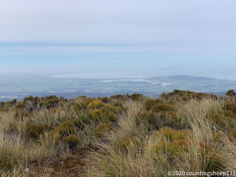
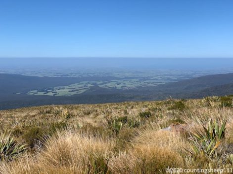
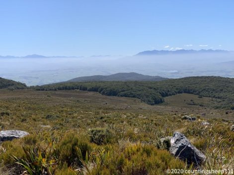
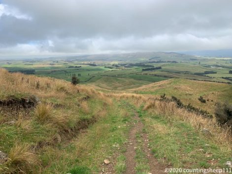
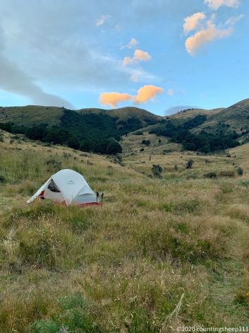
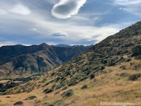
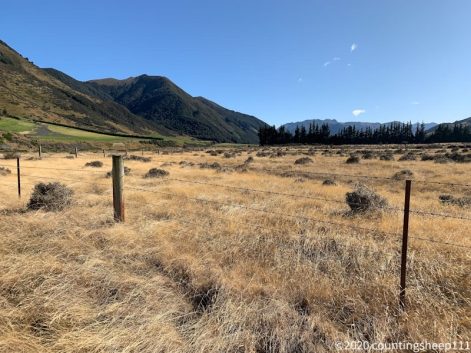
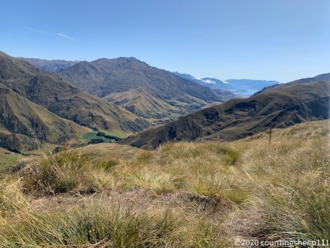
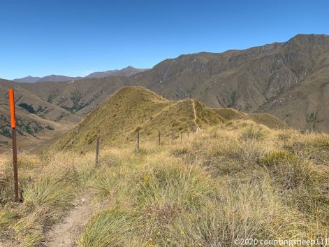
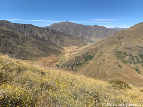
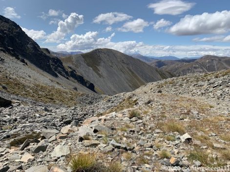
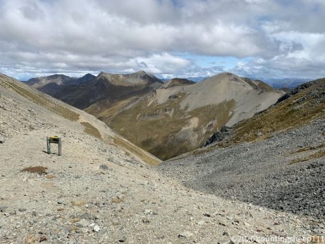
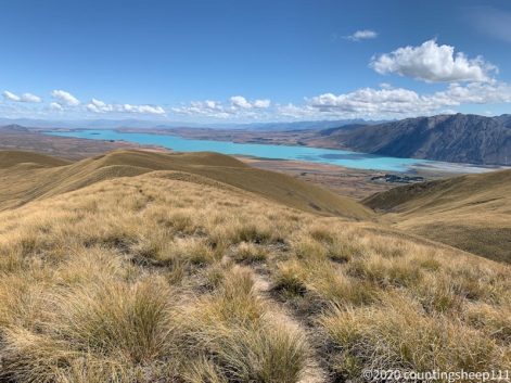
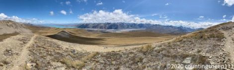
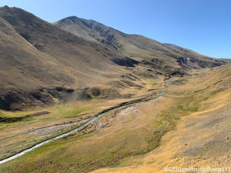
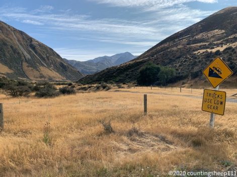
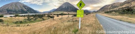
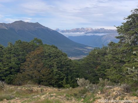
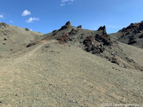
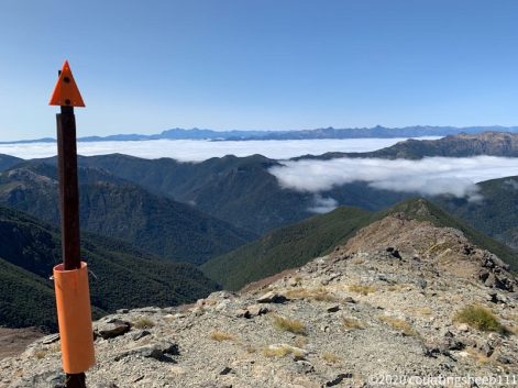
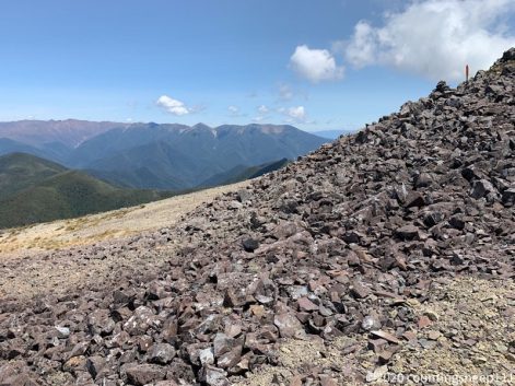
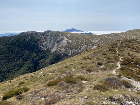
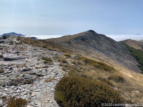
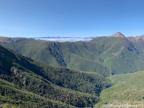
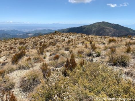
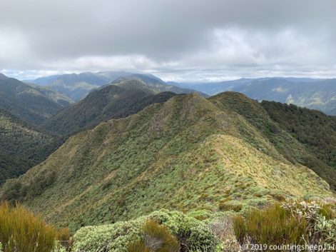
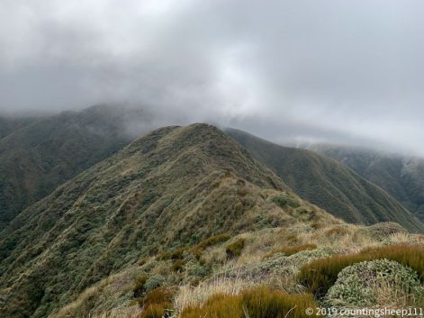
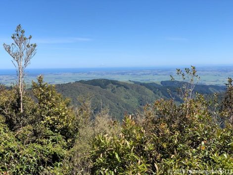
This day started with catching a ride towards Merrivale Rd. Otautau at eight in the morning is not the busiest town. However, after a first lift to Scott Gap Road and a second lift to Merrivale road I was back on the trail around 10.30am. Took me about an hour overall, really not too bad. I walked 16km today. The first 10km and the last 2km on gravel and forests roads. The section in between was a forest track. Longwood Forest is supposed to be one of the muddiest sections on trail. And this first section already had some mud, but not too bad overall. The forest track led to the summit of Bald Hill (805m). In nicest weather (but quite cold, walked the first day of my journey in my long sleeve shirt) I had some great views on to the mountain ranges in the north were I have walked through over the last weeks. And the first time I could see beach and Bluff. So the coast and the southern end of New Zealand is really close. On the summit of Bald Hill are also a couple of antennas. So it does not feel like complete wilderness anymore. Plus there was cell phone reception most of the day. From the summit I walked along a gravel road and pitched my tent 2km down the road at a nice flat spot next to a little stream. The Longwood Forest section I’m walking alone as my company is skipping this section. Next two days will probably be more mud before beach walking is upcoming. The TA ends like it started ;).
Southern end of New Zealand
View from Bald Hill towards North
04.03.2020 – Trail Day 106
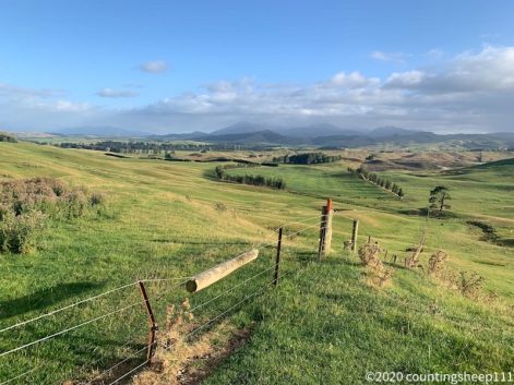
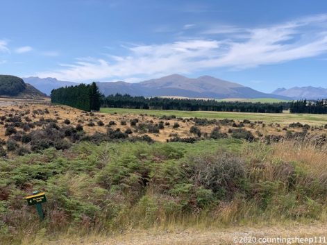
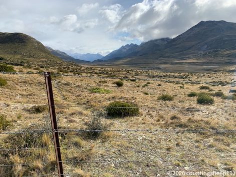
The North Island deja vu continues: today was walking on farm tracks and forestry roads most of the time. All the time through farmed land. And all the time with cell phone reception. That has not happened in ages and shows the most wild sections are now lying behind. Today I walked 22km from Birchwood Station Hut to the Otautau-Tuatapere Road. I expected a pretty long day according to walking times in the trail notes and on the signs. But luckily the trail was smoother than expected. At around 3pm we reached the road and after only 10 minutes we caught a ride into Otautau, about 13km down the road. Over the last two days it became significantly colder. This morning was only 5 degrees Celsius and for the first time since starting the trail I had to wear a jacket even when the sun was out. After some rain drops in the morning while climbing up a hill along a fence line the weather cleared up and it was a sunny afternoon. This allowed for some views on the mountains in the north and west. Back there it was all grey and probably more rain has fallen there throughout today. After the first steep climb the trail followed a forestry road. Afterwards a 1hr downhill section of tramping track followed (including some mud). Onwards the track went along gravel roads and forestry roads allowing for fast walking. In Otautau I’m staying at the Railway Hotel / Pub. A single room for an unbeatable price, time travel back to the 60s included. Otautau is a little town not many tourists come through. So it’s an authentic New Zealand experience. Went shopping for resupplies for the next three days and afterwards had a lot of food at the Otautau Hotel.
Otautau

Finest road walk
03.03.2020 – Trail Day 105
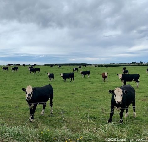
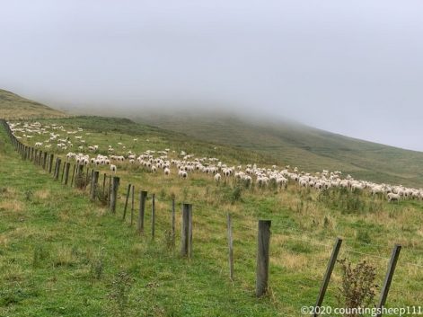
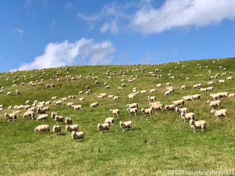
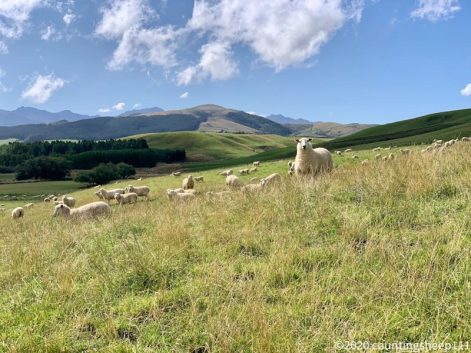
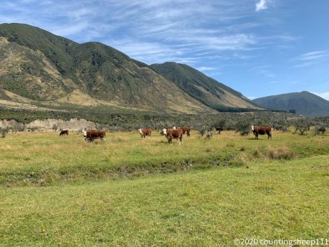
It was a quite stormy and rainy night; not the most pleasant conditions for sleeping in a tent. However, I got at least some hours of sleep just to find out in the morning that mice had fun in my backpack which was lying outside of the fly net of my tent. They seemed to enjoy eating holes in a stack of unused plastic bags. Luckily my food was inside the tent so no real damage other than a mess out of plastic bag pieces. The rain stopped in the morning (at least for some time) which made packing up tent and other gear more comfortable. However dozens of sand flies were around. Maybe rain would have been the better option ;). The walk then started with entering Mt Linton Station, one of New Zealand’s largest farms. For 28km we walked along fence lines and over farm tracks between sheep and cattle. Today less mud but more cattle and sheep poo ;). The first hours were through nice hills. Unfortunately it started to rain again and until late afternoon we were walking in the clouds. Only later it cleared up and we got some nice views on the farmland with many many sheep and cattle. After leaving Mt Linton station we walked to Birchwood Station which operates a little hut for TA walkers. We arrived there around 4.30pm. Highlight of the day was then a hot shower and a home cooked meal (rice with vegetables and fish).
02.03.2020 – Trail Day 104
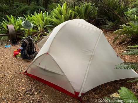
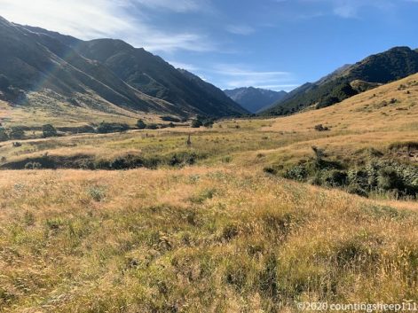
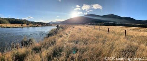
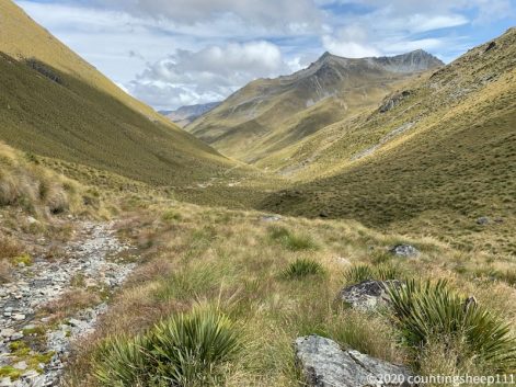
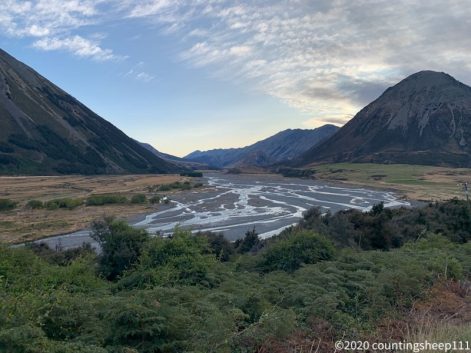
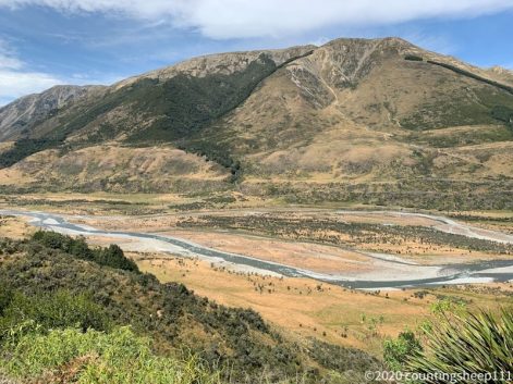
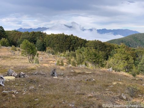
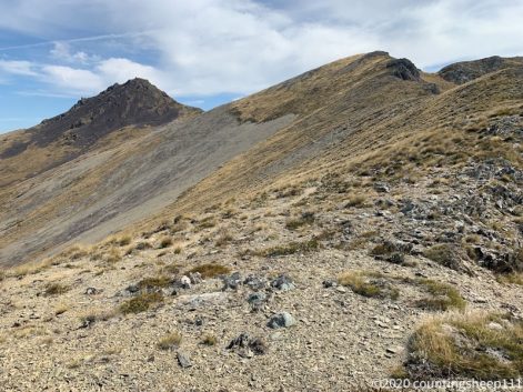
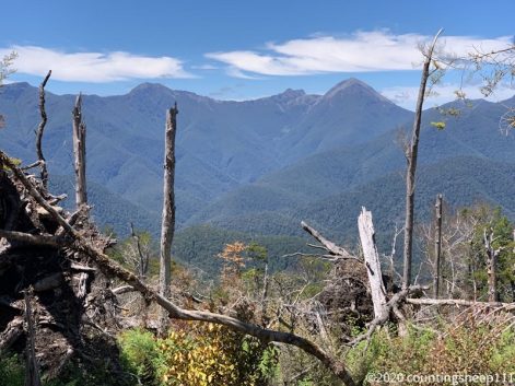
The day started early with a strange noise shortly after midnight. Went out of the tent to check and it turned out a cow had showed up and was eating (luckily on the other side of a fence). We started walking about 7.30am and 8hrs out of10 hrs of walking today was a boring forest walk. Some mud. Some fallen trees. No views. Was a bit depressing after last weeks walking in mostly open areas above the bush line. After lunch break at Lower Wairaki Hut the trail climbed about 500m to a summit and then followed a ridge line. This compensated for the previous forest walk and we had some great views towards the south. For the first time the south coast came into sight. This means the end of the trail is near! After descending along the ridge line (reminded me a bit on the Richmond Ranges; steep descent in parts on a stone ground) and a further descent through some grass land I pitched the tent at Telford Campsite. There is nothing besides a toilet. And I hope the wind does not pick up during the night as there is no sheltered place for tents. Watched some interesting cloud formations forming over the mountains. Haven’t seen this anywhere before. Make great pictures for sure :). Overall it was 10hrs of walking today for 21km from Aparima to Telford Campsite.
Telford Campsite
Finest TA forest walk
First view on South Coast
01.03.2020 – Trail Day 103
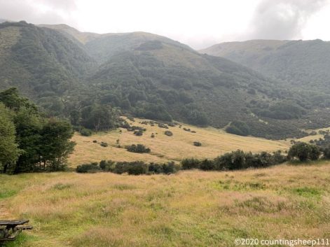
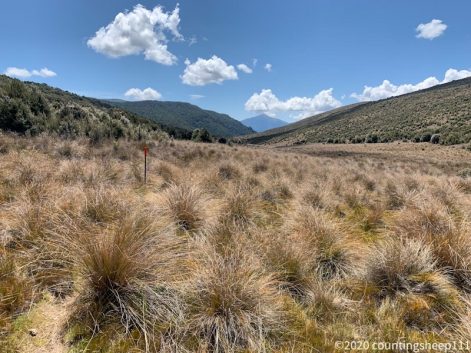
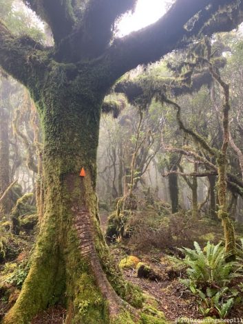
With the first of March fall has officially begun in New Zealand. Luckily it was still a summer day for walking the 22km from Princhester Road to Aparima Hut. After a nice breakfast of pancakes with bananas and bacon (great combination) we walked a couple of hundred meters to find a good spot for catching a ride out of Te Anau to Princhester Road. Sunday morning at around eight is not the most busy time but after about 30min a nice Canadian guy on his way to Queenstown stopped and dropped us off at the trail; about a 25min drive. The first 6km was boring gravel road walking (however some nice views on sheepy hills) before reaching Princhester Hut for an early lunch break. After wondering about some inconsistencies in regards to walking times for the next sections (trail notes vs signs) we moved on towards Aparima Hut. The trail more and more reminded me of the North Island. Climbing up hills in forest with muddy and slippery sections. In addition some tussock sections were also part of the track towards the hut and grass up to the chest made it sometimes hard to find the next pole although this section has one of the highest trail marker densities I’ve seen so far on the TA. Easiest sections were some flat paths through the forest. Walking tussock is an interesting experience but pretty exhausting. At one point I didn’t see a little stream underneath the grass and ended up sitting in the mud surrounded by meter high grass. Shortly before the hut we climbed over a summit with a good view of the surrounding mountains. However it didn’t feel that impressive after the last weeks anymore. Overall a day with a full portfolio of TA experiences, some that brought memories to forests in the Northland back, and some new ones. Pitched the tent at the hut as it was pretty full already. Found it nicer to sleep in a tent and have some fresh air.
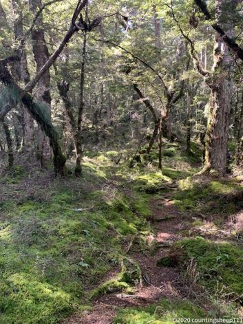
Finest forest walk
View from A1HV summit at 564m
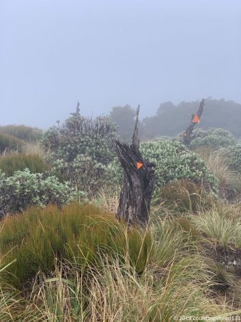
29.02.2020 – Trail Day 102
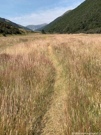
After a not so comfortable night on springy bunk beds and some rain, the day started nicely with sunshine, a cloudless sky, and a bit cold. First section was walking back from Kiwi Burn Hut to the junction with TA for about 20min. Then we crossed Mararoa River; luckily the water level did not rise in spite of rain and crossing was straight forward. The next 6hrs / 16km was walking along a fence line next to the river. A section that had been described as pretty slow going. Alternative would have been road walking. We went on with the official TA route and ended up fighting through bushes, wading through muddy sections, climbing over and under fences, and pushing through high grass and thorny bushes until reaching the gravel road that marked the end of this track. Poles marking the trail were only partly present with long distances between them (at some point TA walkers are conditioned to spot orange colored things in hundreds of meters distance luckily). Parts of the trail have been washed away in recent rainfalls earlier this year. Overall it was exhausting and reminded me of some sections on the North Island. But nevertheless a typical TA fun. That’s what we came for. After reaching the gravel road we quickly caught a ride; the second car driving along stopped and there was room for the three of us (second car still meant about 20min though). It turned out that the guy lives in Te Anau and had walked TA on the North Island a couple of years ago. We had booked YHA Te Anau earlier that day as we found a spot with cell phone reception during the morning hours. Arrived there around 4pm and the usual procedure of laundry, resupply and eating started ;). This time Indian food for dinner, resupply for four days, and the obligatory ice cream for dessert. Was the last evening before our little hiking group splits as the Belgian hiker was only in New Zealand for a section of TA.
28.02.2020 – Trail Day 101
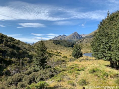
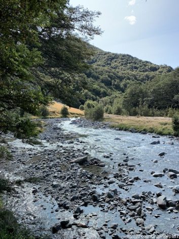
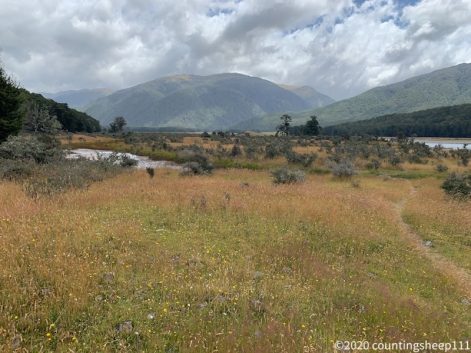
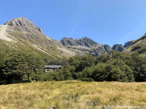
28km walking from Careys Hut to Kiwi Burn Hut today. First 10km was along a 4WD track to Mavora campsite. Pretty easy going with some nice views on Upper Mavora Lake. From there the trail was mostly within forest. Still very easy under the feet with some mud here and there and a bit of up and down. Arrived at Kiwi Burn Hut at 4.30pm and spent an hour eating up my snacks so that there is less to carry tomorrow. Views throughout the day were nice but not spectacular. I’m probably a bit spoiled from the last couple of weeks.
Forest walk
Mararoa River
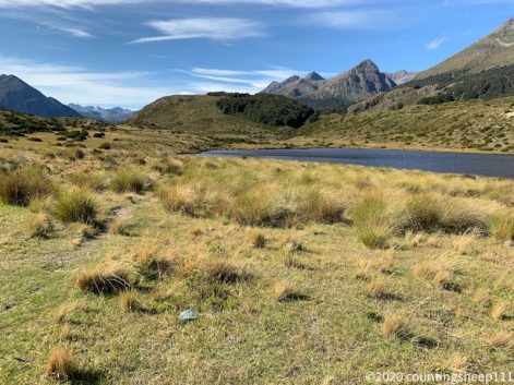
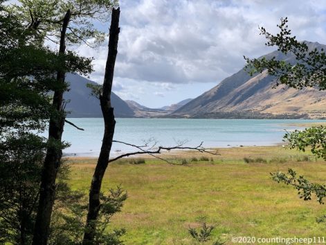
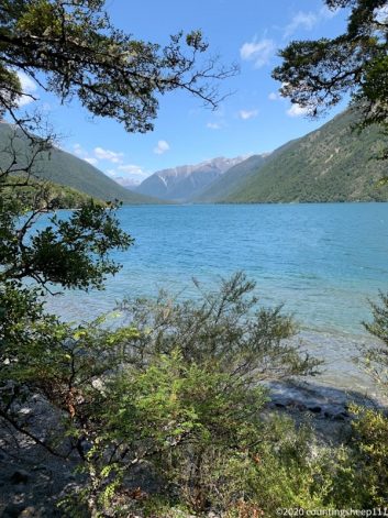
Upper Mavora Lake
Upper Mavora Lake
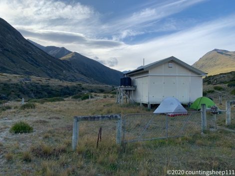
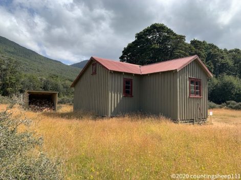
View from Kiwi Burn Hut
27.02.2020 – Trail Day 100
Yeah – 100 days of walking Te Araroa and South Coast of the Southern Island is close. Today we did a short day of 18km from Taipo Hut to Careys Hut with lunch break at Boundary Hut. The day started nice but very windy. Luckily the tent was set up quite sheltered next to the hut last night. We started walking at 8.30am after crossing a swing bridge right next to the hut and made our way Mararoa Valley with great views on the broad valley and the surrounding mountains. We had tail wind which pushed quite hard but the trail did not allow for too much speed. It was quite muddy in sections and some small streams had to be crossed. After 2hrs the wind calmed down and was substituted by rain. For another two hours we walked along the valley and views weren’t as nice anymore. Shortly after twelve we had lunch break at Boundary Hut after crossing another swing bridge and fighting our we thru some meter high grass. The rain stopped after lunch break and the trail was then an easy to follow 4WD track. At 3pm we arrived at Careys Hut and called it a day. The hut is right at the shore of North Mavora Lake surrounded by up to 1600m high mountains. A very nice setting.
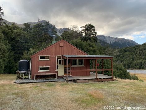
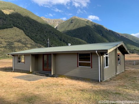
Careys Hut
North Mavora Lake
Shortly before reaching the lake
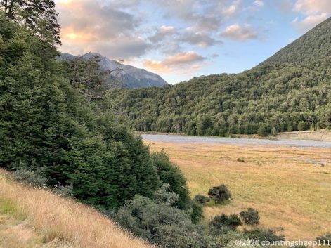
The scenery right after leaving Taipo Hut
26.02.2020 – Trail Day 99
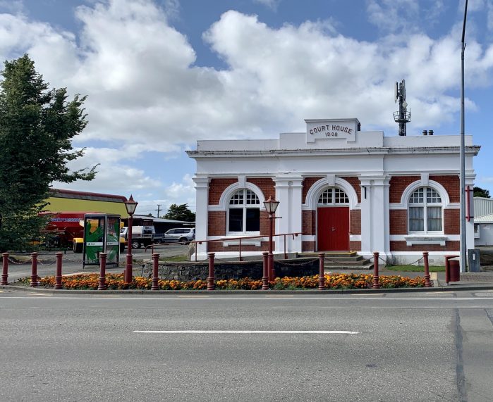
Finally back to walking muddy forest tracks and climbing over or under trees. Took the shuttle this morning from Queenstown to Greenstone car park via Glenorchy. After 1.5hrs driving, the last 30min on a rough gravel road with some fordings, we arrived at Greenstone car park. There TA continues after Queenstown. The first 3.5hrs was easy walking along the Greenstone Track to Greenstone Hut. In some places the track got washed away earlier this year and some walking over gravel fields was required. But all well marked. The track goes mainly through forest and in some sections along the river. After lunch break we left the Greenstone Track and joined the Mavora Walkway for 10km towards Taipo Hut. This section was more slow going and felt like walking on the north island. A lot of mud holes and some trees blocking the path. But there are definitely worse section and after leaving the forest we had some nice views while walking along the valley. Last couple of kilometers was walking through high grass and on a swamp like surface. Quite interesting. And leading to wet and muddy shoes and socks. Arrived at the hut after overall 22km. Hut was full so pitched the tent and now hoping for a dry and not too stormy night.
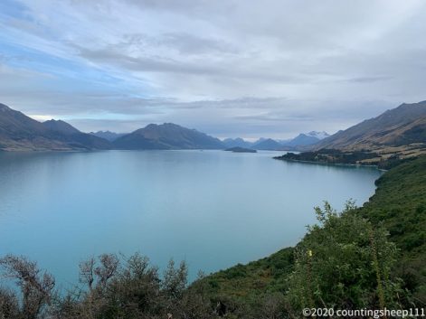
On the way to Glenorchy – Lake Wakatipu
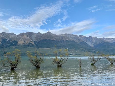
Glenorchy Trees
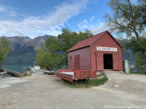
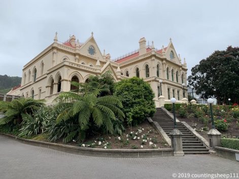
Supposedly the most photographed building in New Zealand
Greenstone Track
Greenstone Track
Mavora Walkway I
Mavora Walkway II
Mavora Walkway III
Taipo Hut
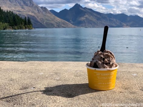
25.02.2020 – Rest Day at Queenstown
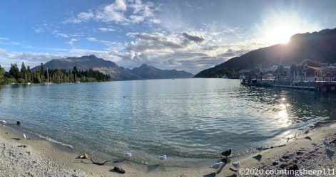
After many days of walking today was the first full rest day in quite a while. In nicest summer weather I have spent the day doing laundry, eating (especially sweet things like ice cream two times 😉 ), shopping for food for the next section and looking around Queenstown. Looking at Lake Wakatipu and the adjacent mountains definitely is a nice scenery. The town itself is very artificial and very touristic. Many young people come here for partying and having the one or other outdoor adventure activity: skydiving, bungee jumping, rafting, jet boat – you name it, Queenstown has it ;). I was happy with getting a real coffee for breakfast and pizza for dinner. Walking the TA is enough of an adventure. Booked also the shuttle to the next trail head around the lake. So our little European tramping group (Belgium, France, Germany) which found together over the last weeks will move on tomorrow.
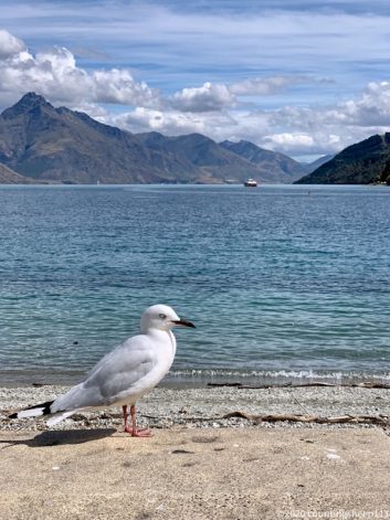
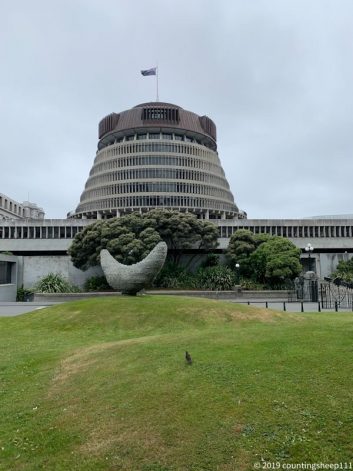
Angry bird

Choose your adventure
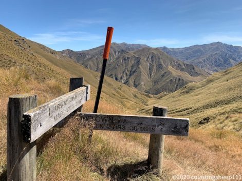
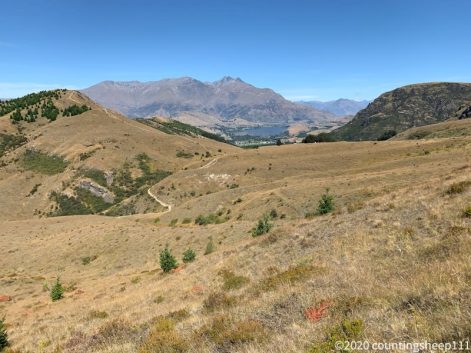
24.02.2020 – Trail Day 98
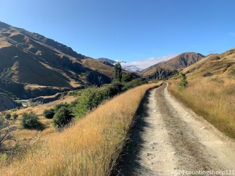
After a good and cold night at Macetown we had a lazy start in the morning. Woke up with the sand flies and started walking only at 9.45am. The trail went along the old main street of Macetown – an abandoned gold miners village. But not too much left to see; some stone walls here and there and that’s about it along the street. After fording the river multiple times we made our way along the Big Hill Track and went to Arrowtown via Big Hill Saddle. A climb up to 1054m and from there descending 600m into Arrowtown. The way up went through some muddy tussock and thorny bushes in places. There was a nice view from the saddle but not as spectacular as the previous days. But there was cell phone reception which allowed for booking tonight’s accommodation. From Arrowtown we took a bus to Queenstown skipping walking the section between the two towns. Queenstown is very touristic and with me arriving the average age of visitors significantly increased ;). Had a nice lamb burger and milkshake for dessert. And took a look at Lake Wakatipu.
Macetown Main Street
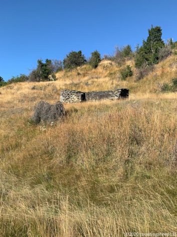
Macetown Ruins
Up on Big Hill Saddle
Descending towards Arrowtown
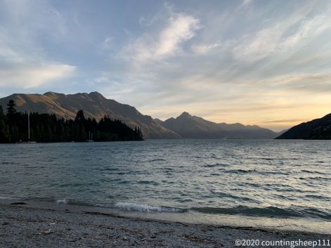
Lake Wakatipu
23.02.2020 – Trail Day 97
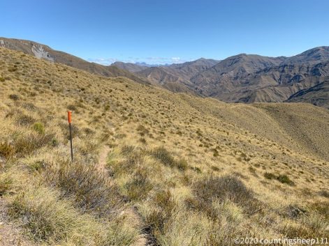
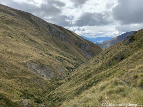
Today was a big day: leaving Highland Creek Hut at 7.15am and arriving at Macetown Campsite at 7pm. Distance was 21km and the day included three 500m ascents followed by 500m descents along ridge lines. Fantastic panoramas and an almost cloudless sky added to a great tramping day. Lunch break was at Rose Hut right after the second descent. From there the trail went up to Roses Saddle at 1270m. Until after the last descent the trail was easy to follow but steep now and then. After the last descent we choose the low river route. This let to walking in the river a good amount of the last couple of kilometers. Luckily the water was only knee high. Only the last kilometer we followed an old 4WD track which allowed for easy walking but nevertheless numerous crossings of the river. Quite exhausted we arrived at Macetown campsite, got attacked by millions of sand flies, pitched tents and called it a day. I have spent about one hour eating various snacks and dinner. Seems like I have burned some calories today. According to my phone today’s trail day had the most meters ascent so far.
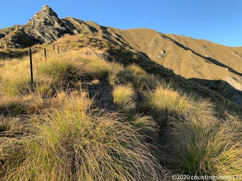
First climb in the morning
View back on Lake Wanaka from second high point (including cell phone reception)
Ridge line walk ahead
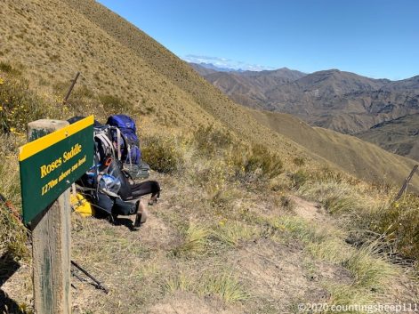
Third high point: Roses Saddle
22.02.2020 – Trail Day 96
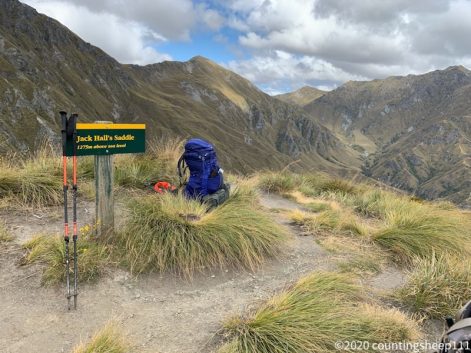
This morning started with a little drizzle. But as the holiday park has a proper kitchen and lounge it was a pretty comfortable start in the morning nevertheless. It cooled down quite a bit at night and a slept with a closed up sleeping bag. That did not happen in a while. Up in the mountains there was also some new snow visible. The weather cleared up around 8.30am and we started heading towards the trailhead of the Motatapu Track. The first two hours was walking in the forest before the track went over the bush line. Shortly after we reached Fern Burn Hut for lunch break. From there the track climbed steadily, steep in places, but always good to follow towards Jack Hall’s Saddle at 1275m – the highest point of this section. During the climb we had some nice last views on Lake Wanaka. After the saddle the trail continued along the ridge surrounded by great scenery. The mountains have quite a special shape. We arrived at the nicely located Highland Creek Hut around 4.30pm. Both huts are pretty new and spacious (12 bunks). Overall a 16km stretch too with about 1000m climb.
View back on Lake Wanaka
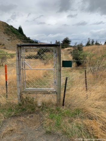
A new stile style
On the saddle
Highland Creek Hut ahead
21.02.2020 – Trail Day 95
Had a very wet and dirty start to the day as it was pouring down while packing the tent and stuff. And the dust of the campground floor stuck well to all wet gear. Luckily we found a little cafe and bakery close by for an extended breakfast while waiting for the rain to end. Had two very tasty pain au chocolat and a danish along with flat white coffee. And after an hour more and more blue sky appeared over the mountains and we set off to Wanaka. Arrived at eleven with a long shopping list for gear and food for the next section. I have now new socks, a new squeeze bottle for my water filter, a new dry bag, and new shoe laces. And food for the next couple of days. After a proper lunch (bagel with salmon) we started to walk towards Glendhu Campsite along the shoreline of Lake Wanaka. The walk was more exhausting than expected. Although it was a well maintained track it continuously went up and down. We arrived at the campsite only shortly after five and I had quite a couple of things to do on my list. Started with setting up the wet tent; luckily it was sunny and it dried up quickly. Then laundry. And a nice hot shower. Afterwards spent the evening sorting food, sewing shoes, charging the power bank, and taping a dry bag. Quite some to do’s compared to hut life once there is some civilization around ;). Besides, the trail along Lake Wanaka has nice views on the mountains and some vineyards. And passed by ‘That Wanaka Tree’, a surprisingly popular tree in the water. Overall around 22km today.
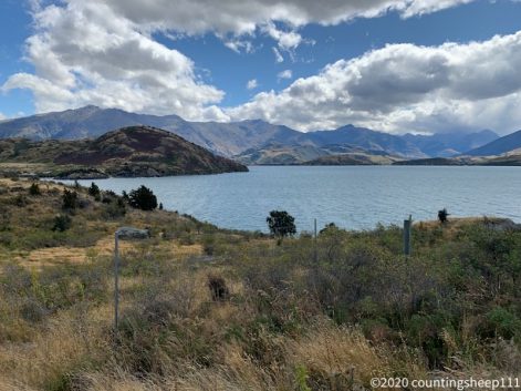
Lake Wanaka
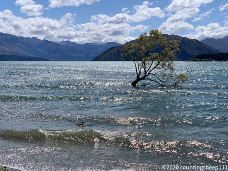
That Wanaka Tree
20.02.2020 – Trail Day 94
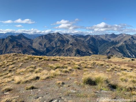
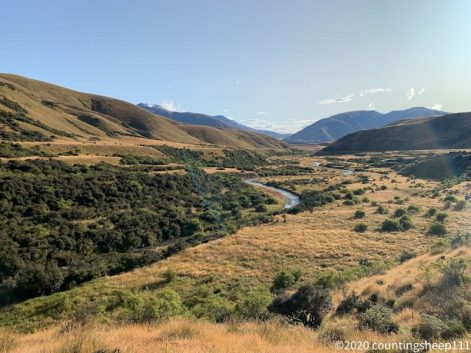
The day started with a 900m descent from Pakituhi Hut down to Lake Hawea. The track followed a ridge line with some steeper drop offs and good views on the lake. There were some more clouds than the day before, so colors weren’t that nice. The last 200m descent was an easy to walk zig zag path and we arrived at the lake around 11am. Walked along the shoreline for two hours before reaching Lake Hawea village for lunch. This time a cheeseburger, fries, smoothie, and ice cream. A welcoming change to Nutella and peanut butter wraps ;). Afterwards it was another 2.5hrs easy walk along Hawea River to Albert Town campgrounds. This was flat and not really exciting but some nice scenery here and there. And a nicely colored river. After pitching the tents at the campground (which is quite filled with camper vans) I walked 10min to the town center. Not too much around here, but a supermarket. So dinner was cheese and crackers and yoghurt. And there seems to be a nice cafe, so I hope for fresh coffee in the morning :). Overall 23km of walking today.
Way down from the Hut
Views during descent
On the right the mountain range we came from
Hawea River
Walkway to Albert Town
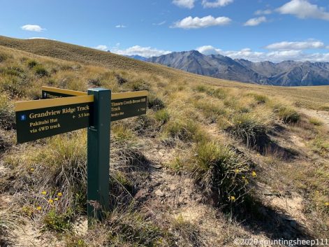
19.02.2020 – Trail Day 93
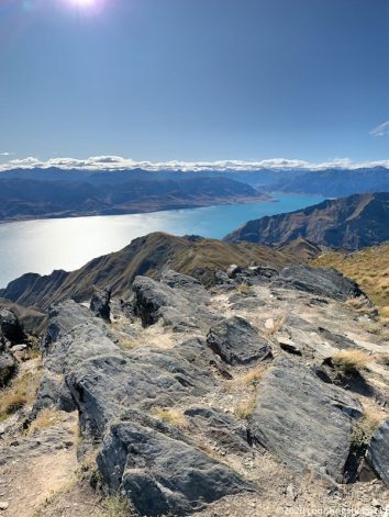
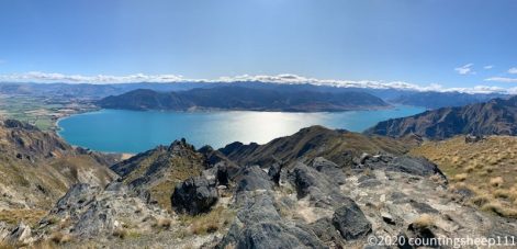
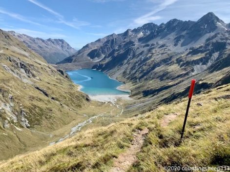
This day began with a hole in my food bag. Some mice obviously tried to get to my Nutella wrap. And although the food bag was at a hook, mice managed to climb onto and make a hole. Luckily they did not get to the food itself, but only through three layers of plastic bags. After breakfast at 6.30am a 12hrs long hiking with 1500m ascent and 1100m descent started with the full spectrum of what TA has to offer: easy farm tracks, river walking, river crossing, steep climbs, stunning views, cell phone reception on the summit, and a great hut. All this occurred within 24km between Top Timaru Hut and Pakituhi Hut. We left with sunrise around seven and the first kilometer was easy. Afterwards the trail followed the Timaru River. For the first couple of kilometers we walked in the riverbed instead of sticking to the trail; some northbound hikers suggested this as being the easier route. Worked well and we made good progress. Two hours later we joined the marked trail which went high above the river just to descend afterwards towards the river again. So typical TA routing ;). It took us an additional three hours, numerous river crossings, and many ups and downs to complete this 12km long first section of the day. Removed the debris out of the shoes to get ready for the climb to Stodys Hut (and destroyed yet another pair of socks): 1.5hrs and 500m climb straight up the mountain later – zig zag trails are overrated – we had a late lunch break at Stodys Hut (not so nice hut). From there onwards one of the most beautiful TA sections started: climbing up 500m more and following a ridge line to Breast Hill at 1578m. All on very easy to walk on farm tracks, but nevertheless exhausting. On top of Breast Hill summit there was 4G cell phone reception and – probably more important – stunning views on Lake Hawea and many mountain ranges. We spent half an hour up there enjoying the views and taking tons of pictures. The last part of the day was the descending towards Pakituhi Hut; this took about an our still following the ridge line but again an easy path. Reached the hut shortly after seven and started to eat all I could find ;). The hut is really nice and new, built 2011. So quite a highlight of this section and I’m happy the we decided for a long day today.
Up from Stodys Hut
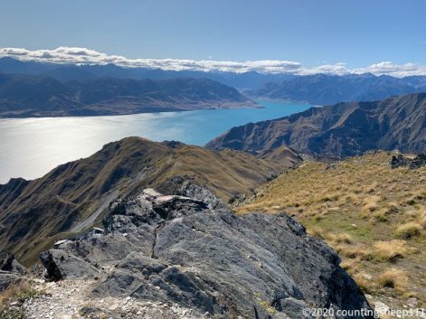
Lake Hawea from Breast Hill
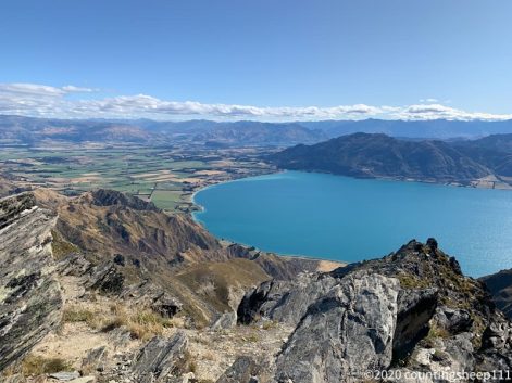
Lake Hawea
18.02.2020 – Trail Day 92
This day started pretty early; shortly after midnight a thunderstorm came through and and the tent was lit up by lightning. Luckily it was not too close but some rain fell nevertheless. In the morning the weather was fine again to set off to Top Timaru Hut, a 22km walk with climbing 1000m and descending 900m. The trail was easy going all the time; mostly following an old 4WD track with only some washed out or muddy sections here and there. But I’m a bit exhausted anyways ;). Took a first break a Tin Hut to dry up the tent before continuing towards Martha Saddle at 1680m. From there it was a 2hrs walk to Top Timaru Hut which we reached around 4pm. The hut is nice and pretty new, but quite small with only 6 bunks. Luckily we just scared away three other hikers who decided to pitch their tent. So the hut is only half way full now ;).
View back on campsite
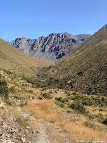
Today’s scenery
 Martha Saddle at the horizon
View from saddle
View from saddle
Looking back to the saddle
Descent along the valley
Hut
17.02.2020 – Trail Day 91
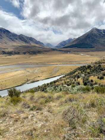
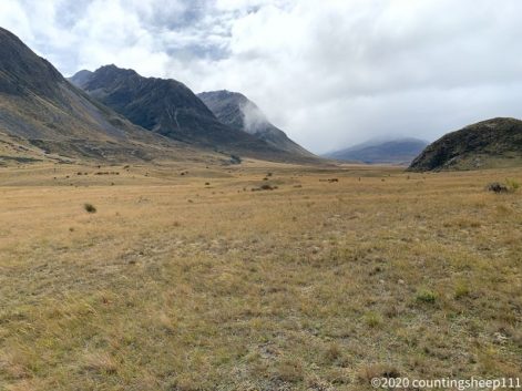
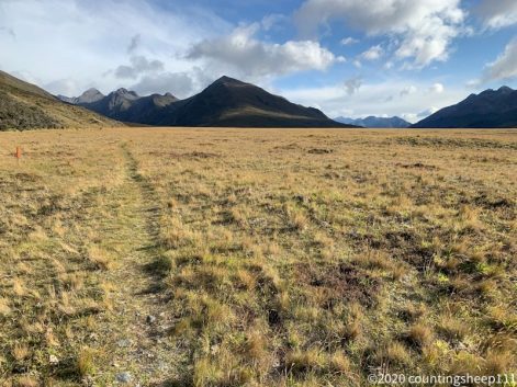
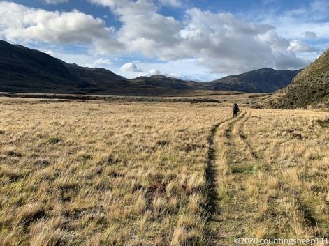
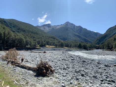
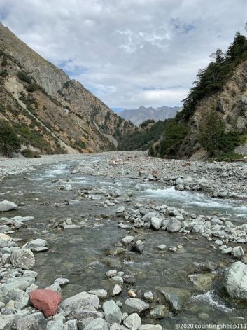
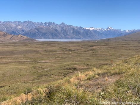
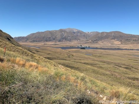
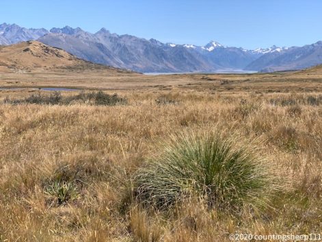
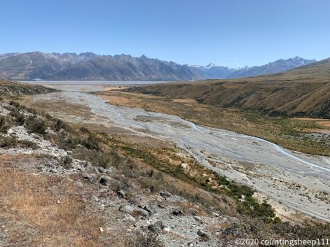
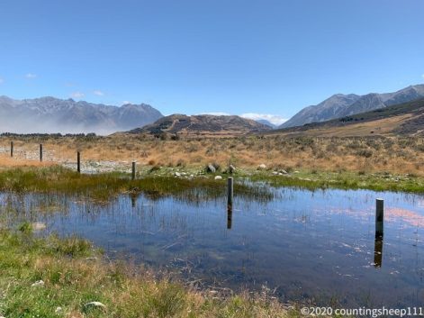
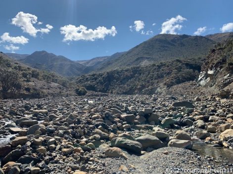
Long day of hiking today: got up at 5.30am and we left at 7am. Arrived after 31km and 1000 ascent and descent at 6.30pm at a nice camping spot right next to a little stream for freedom camping; no huts or campsite anywhere near. Luckily the tropical cyclone did not lead to heavy rain in the area I’m currently hiking in. After some drizzle in the very early morning hours, there was no rain the whole day :). Even the tent was dry when packing it up. The track today started with 3km of road walking followed by a couple of east kilometers along the Alps 2 Ocean bike track. Afterwards we climbed above the bush line along Freehold Creek. Overall a very well formed path up to the highest point of the day at about 1400m. During the climb we had some nice views on the sun rising over Lake Ohau before the track turned and led over a saddle covered in tussock. This let to some wet and muddy feet. The descent went along the Ahuriri River East Branch with some back and forth over the stream at the beginning. Later on, as the valley became wider, the track was very flat and went along some farmland. Felt again like waking in a desert with yellow grass and dust all around and some mountain ranges at the horizon. In the late afternoon we crossed the Ahuriri River, the largest unbridged river on the TA on the South Island. Water was somewhere between knees and hips but crossing was doable. Although it took quite some time as prior to each step poles need to be positioned for giving a stable stand against the current. After the crossing a steep climb followed back up to the track. Next highlight was then crossing the 2500km mark! Another 4km later we reached the spot we had identified for camping according to comments in the app. After the usual procedure – setting up tent, filtering water, cooking dinner, eating nuts & chocolate, preparing breakfast and lunch, watching the colorful sunset – I’m now ready to fall asleep. But just now a lost hiker screamed from somewhere in the bushes and asked for directions to the camp spot. Quite impossible at night to give guidance as there are fences, thorny bushes and little streams. She decided to camp somewhere else and figure it out in the morning. Somewhat scary though nevertheless.
Early morning at Lake Middleton Campsite

Sunrise over Lake Ohau
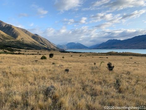
Last views on Lake Ohau
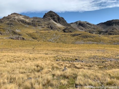
Going up Freehold Creek Track
Way down ahead
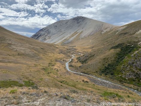
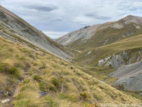
Ahuriri River East Branch Valley
Ahuriri River
16.02.2020 – Trail Day 90
Today’s walk is a good candidate for being South Island’s most boring TA section. After having a proper breakfast and coffee at Twizel, I started walking at nine towards Lake Middleton campsite. About 30km walking on gravel roads and gravel bike paths along Lake Ruataniwha, Ohau River, and later Lake Oahu. Some nice views but as clouds were coming in, no comparison to the last days. Had some drizzle throughout the day, but no heavy rain. Hope weather stays like this as yet another storm, a tropical cyclone, is supposed to hit the west coast of the South Island and several weather warnings have been issued. As the next section is not too close to the west coast I hope for no major impact, especially as a river crossing is required tomorrow close to the end of the section. Meanwhile pitched the tent at Lake Middleton and enjoyed some tent time with rain drops falling on the tent. This campsite is actually a luxury one: flushing toilets, toilet paper, and some cell phone service. Haven’t had that in a while ;).
Lake Ohau
Ohau River
Ohau River
Lake Ruataniwha
15.02.2020 – Trail Day 89
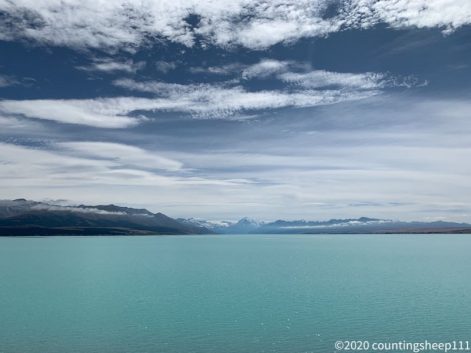
Today was 53km by from Tekapo to Gondor Twizel along the Alps 2 Ocean cycle trail which is also the TA. Biking is the most feasible option for this stretch as there is no accommodation or camping along the way. Plus it is a designated bike path and almost flat. Started around nine and headed towards the channel between Lake Tekapo and Lake Pukaki. These 30km were pretty boring; views were not really exciting and it was overcast. But as soon as we reached Lake Pukaki and followed the bike path along the shore lines sun came out and some great views on Aoraki/Mount Cook and the lake totally made up for the first thirty kilometers. The trail continued through Pukaki Flats – still with the Aoraki/Mount Cook massive – visible at the horizon. Reached Twizel around 2pm and checked in at the backpackers. The place is a bit worn down though ;). Got supplies for the next section (five days) and enjoyed a strawberry milkshake. Fun fact about Twizel: there are two supermarkets of the same chain (Four Square) 100m apart. Not sure about the reasoning ;). Overall today was almost a rest day. Especially as riding the bike was a nice change: not carrying a heavy backpack and 50+km within a couple of hours. Completely new experience. And walking definitely does not train the muscles needed for biking ;).
Sunrise at Lake Tekapo
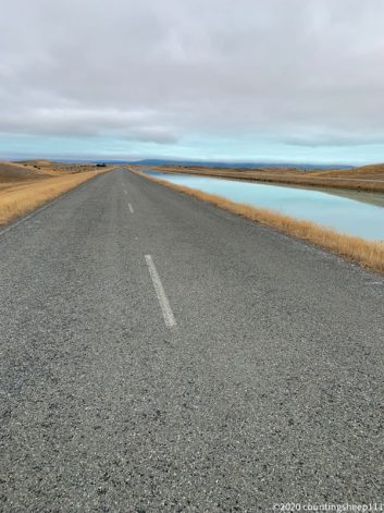
Biking along the channel
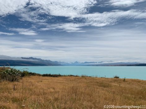
Lake Pukaki
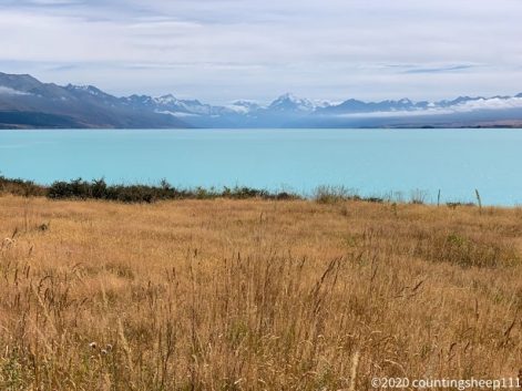
Aoraki / Mount Cook
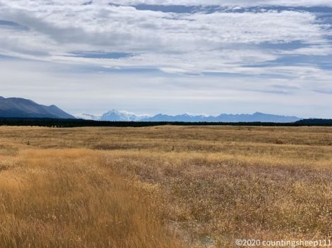
Pukaki Flats aka Gondor
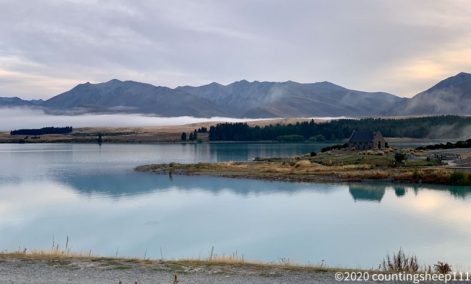
14.02.2020 – Trail Day 88
Walked out from Camp Stream Hut today to Tekapo village, about 20km of walking and hitchhiking for 13km. For a couple of hours the hills were covered in clouds; still nice scenery but no views on Lake Tekapo or mountain ranges. First section of the trail was following a river bed. Some washed out sections, rock hopping, and wet feet included. After a pretty steep climb the trail became much easier and went along another ridge (Richmond Trail). Felt almost like road walking, just without cars. Weather became better and some nice views on Lake Tekapo occurred. The trail descended over 13km towards a gravel road along the shoreline of Lake Tekapo. We were lucky and the first car that came by stopped to give us a ride (South Korean couple on honeymoon 🙂 ). Especially since only one car every thirty minutes or so was driving there ;). Arrived at the YHA right in time to check in. A very new and nice place with a great view on the lake. Did some laundry and got the bike for the next section to Twizel. Also walked around a bit and had a pretty good lamb burger. But there is surprisingly little to see besides the admittedly nice panorama of the lake and mountains at the horizon. Got one of the last beds at the YHA, so Tekapo seems to be a pretty busy spot nevertheless ;). Pretty popular is the Church of the Good Shepherd; behind the altar is a window with a nice view on the lake.

Cloudy start into the day
Weather clearing up
Happy Valentines Day 🙂
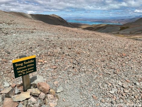
Somewhere back there is Stag Saddle
13.02.2020 – Trail Day 87
After Waiau Pass, today was the second day on trail with really breathtaking scenery. After leaving Stone Hut with a light drizzle it took about 2hrs walking along Bush Stream to reach Royal Hut (where supposedly Prince Charles and Princess Anne used to stay when they where children; the hut is probably about that old 😉 ). From there it was a 3hrs ascent to Stag Saddle (1925m), the highest point on TA. By the time we came up there sun came out and there were fascinating clouds. From Stag Saddle the trail follows along a ridge line for several kilometers with stunning views on Lake Tekapo on the one side and snow covered mountain ranges on the other side. After about 3hrs of walking on the ridge line (which was a surprisingly easy track) the final descent to Camp Stream Hut started. Shortly before reaching the hut we had to fill up water as there is no water source nearby. Pitched the tent at the hut as it is quite busy and the hut is really small. Met some fellow hikers again that got stuck at Kiwi Hut for three days due to heavy rain (and skipped a section afterwards) shortly after we made it out from there. Overall it was 21km of walking from Stone Hut to Camp Stream Hut and the section definitely being a highlight of the trail.
Second breakfast at Royal Hut
Walk to Royal Hut along Bush Stream
Climbing up Stag Saddle
Walking down along ridge line with view on Lake Tekapo
View back on the crossed Stag Saddle
12.02.2020 – Trail Day 86
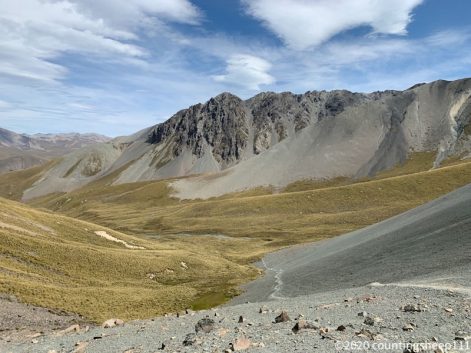
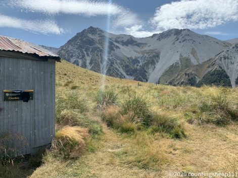
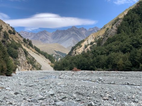
Exhausting 19km and 9hrs of walking today from Bush Stream Car Park to Stone Hut (1104m). After having a breakfast burrito at Geraldine we took the shuttle to Bush Stream Car Park (to again get around a river that is dangerous to cross). Left Geraldine at 8.30am and arrived at the car park around ten after driving the last 30min on gravel roads. Still quite impressive which distances need to be covered. The first 3hrs of the trail (called Two Thumb track) was stumbling along Bush Stream river bed with very little trail markers present. At one point a marker was visible with the trail leading over a little hill. But due to heavy washouts the access was not possible and we had to stick to walking along the river. Some good number of crossing back and forth over the stream later the trail became well formed and climbed up to Crooked Spur Hut. We had a late lunch break there and decided to move on another 5hrs to the next hut. Luckily the trail was decently marked with poles from there on. Nevertheless some pathfinding through grass bushes was necessary. The trail climbed steadily and was well walkable up to a saddle (1500m) with great views. From there it was still a three hours descent with some ups and downs over grassy hills and across small streams. After the last crossing of Bush Stream – this time via bridge – we arrived at rustic Stone Hut at 7pm.
Stone Hut
After saddle
Saddle @1500m
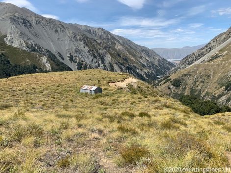
Crooked Spur Hut
View from Crooked Spur Hut
First section of the trail
Looks idyllic (but after walking along the riverbed for hours, it’s not too idyllic anymore 😉 )
11.02.2020 – Trail Day 85
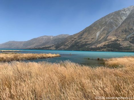
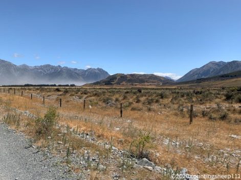
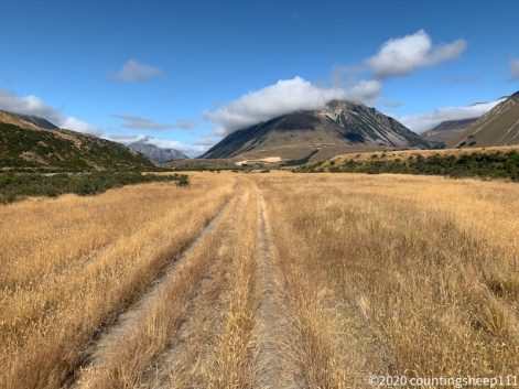
Walked 32km today and it felt like walking in a Lord of the Rings movie set. Started at 6.30am with the full moon still shining. First section was some small hills covered in great lights as the sun rose. Afterwards the track went through some flat and dry farmland with yellow being the predominant color of the landscape. With some hills around without much vegetation the scenery reminded me of the area around Las Vegas. After some kilometers on a gravel road the 20km long Clearwater Track started. After a couple of kilometers the landscape completely changed and we walked in a greenish valley with a magnificent view on snow covered mountains in the distance. That’s where some scenes of Lord of the Rings have been filmed. The track continued along the valley without any major climbs and descended to Potts River with nice views on Lake Clearwater. Arrived at 3.30pm at the car park where a shuttle picked us up at 4.30pm. Arrived at Geraldine around 5.30pm and checked in at the backpackers. Went to get some resupplies and a pizza for dinner at the local pub / sports bar. The waiter brought the pizza in a paper box and mentioned people usually won’t finish it, thus the box for taking away the leftovers. Well, no leftovers after 32km of walking ;).
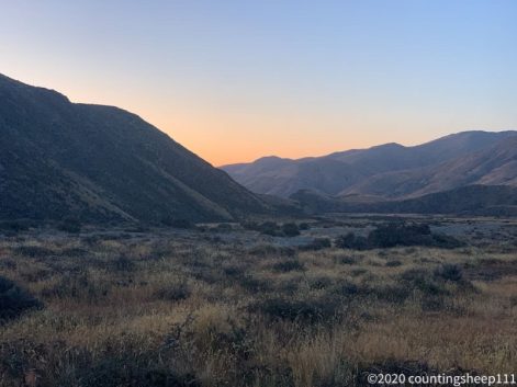
Early morning start
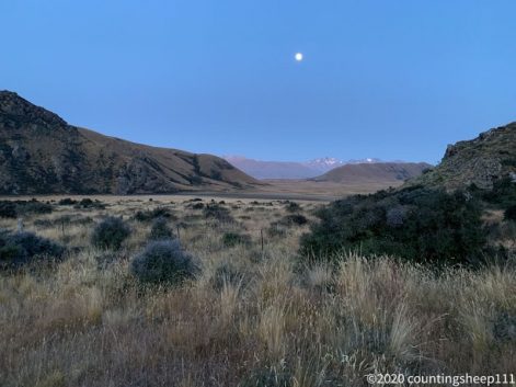
Moon still up
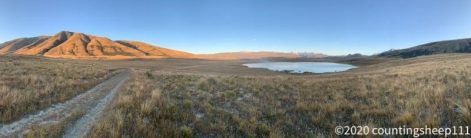
Lake Clearwater
Potts River
10.02.2020 – Trail Day 84
Today was a 21km walk from Comyns Hut to Manuka Hut over Clent Hills Saddle. The first three hours the trail followed a river including countless crossings and wet feet; stopped counting after 30 ;). Trail was not too well marked leading to some back and forth here and there. For the next section the river had been substituted by high grass. Not as slow going as before but still some sort of “choose your own path between the poles”. But finally made it up to Clent Hills Saddle (1480m) for lunch break. From there the track became easier to follow and descended over some ridges and gravel fields always with great views on the surrounding and distant mountain ranges. The last couple of kilometers the trail was a 4WD track, easy to follow and pretty flat. But summer is back and it felt like walking in a desert. Even the ground was sandy here and there. Luckily many streams are on the way so that there was no need to carry lots of water. We arrived at Manuka Hut around 4pm. Hut was full already so pitched my tent for the night. Besides the little more effort on the morning when packing, it is actually nicer to sleep in a tent; less snoring people and far better air ;).
Clent Hills Saddle
Manuka Hut
09.02.2020 – Trail Day 83
After a great and big burger and two beers (Tuatara Pilsner) at The Dubliner – one of three pubs in Methven – I had a very good sleep at the hostel. After waking up I got some fresh fruits and a flat white coffee as add-ons to my muesli breakfast. The shuttle around Rakaia River picked us up at noon and we hit the trail by 1pm. After some walk across farmland (including sheep and cattle) the trail climbed steadily over Turtons Saddle (1120m) following an old farm track. After climbing over the saddle the track follows a valley (including some river crossings) with quite some impressive views. Yet another landscape compared to the previous section. 5hrs after starting – including a break at funny looking A-Frame Hut – we arrived at Comyns Hut shortly before six. The hut is a bit old style but still nice.
Last view on Rakaia River
A-Frame Hut
Glenrock Stream Valley
Comyns Hut
Also Comyns Hut but still some meters to go
08.02.2020 – Trail Day 82
Left early this morning (7am) as the goal was to make it to Methven. That worked out and I checked in at the Snow Denn Lodge around 2pm. First three hours of the day was walking along a gravel road. After about 15km I caught a ride with two hunters. Was sitting in the loading area of the truck next to two shot pigs with a fellow hiker for 20min before we got dropped off at Coleridge Rd, Dog Box Corner. A somewhat scary ride, but better than road walking ;). After only a couple of minutes got the next ride which led us to 11km in front of Methven at the highway junction. A quite busy road actually but took us 1.5hrs (of which the last 45min it was pouring down) before a nice couple with a dog picked us up and took us to Methven (dog enjoyed licking my face while I was buried under a backpack on the rear seat). Could have almost walked in that time ;). Methven is a nice little village. Probably pretty busy at winter time but with two supermarkets, three pubs and some cafes quite enjoyable. Got a flat white coffee and a date scone right after arriving ;). Also booked the shuttle to the next section of the TA for tomorrow as this starts on the other side of Rakaia River which one is not supposed to cross due to safety reasons. And now I’m off to enjoy some real food tonight :).
07.02.2020 – Trail Day 81
Started around eight at Hamilton Hut and walked the Harper Valley Track to Harper Road Campsite. Half of the trail was a good to follow 4WD track with many river crossing, i.e. wet feet day. The other half was bashing through some bushes and across little streams as no trail markers were present (or I did not manage to spot them). Tried to stick to the GPS track in that cases but to avoid thorny bushes. Two conflicting targets for the most part. Arrived at the campsite already around 1.30pm after waking about 20km. As the next 30km do not have any possibility for camping or was advised to stay here. The campsite is close to Lake Coleridge and I took a walk with a fellow hiker to have a look at the lake. Incredibly blue water but overall not too exciting. Walked back to the campsite and pitched my tent. It’s quite a hot and sunny day and I would wish for some shadow or roofed shelter. But nothing here besides a toilet and a picnic table. A very basic campsite ;). The walk along the valley had some amazing views on mountain ranges, some of them covered in a dust storm. And on The Pinnacles. And probably best thing of the day: got offered a cold beer by a hunter right at the end of the track. Great way to conclude a days section.
Lake Coleridge
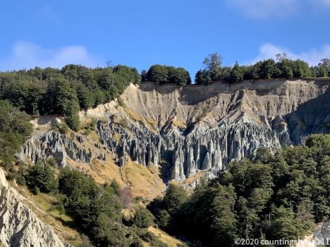
The Pinnacles
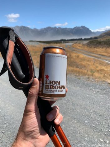
Welcome Beer 🙂
06.02.2020 – Trail Day 80
Back to walking the TA. After a couple of bad weather / rest days I walked today from Cora Lynn car park to Hamilton Hut, about 16km. With this I’m skipping the Mingha-Deception trail. Was really keen to do it but due to weather and the Coast to Coast race going over this section, walking it would have meant waiting another two days. So will have to come back some time to do it ;). Got some entertainment in the morning as a couple of Kea birds were attacking one of the tents pitched in the garden of The Sanctuary. To get to the trail head of today’s section we started trying to catch a ride out of Arthur’s Pass around 8.45am. No luck for 1.30h and pretty cold weather with a drizzle. Thus went for a coffee and afterwards we were lucky and caught a ride with a nice lady who took us to the car park of the trail head (about 15min). From there it was 6hrs walking along a mostly well formed track. A slow climb over Laggon Saddle and afterwards following the Harper River valley. Some wash outs and mud here and there but mostly nice walking with nice views on surrounding mountains. And two short stops at Lagoon Saddle Hut and West Harper Hut.
Harper River
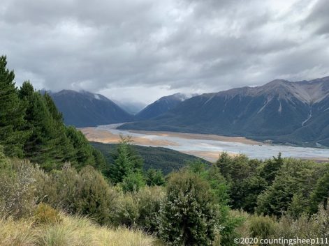
Last view on Arthur’s Pass
Hamilton Hut
05.02.2020 – Arthur’s Pass
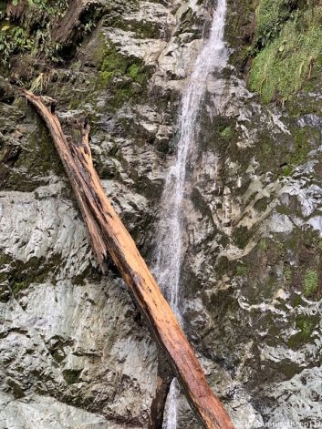
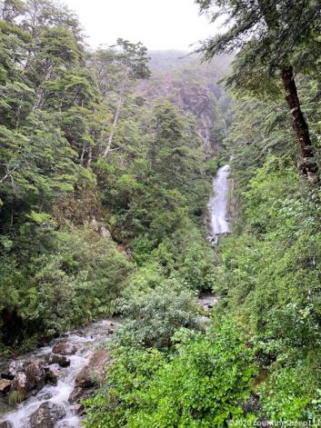
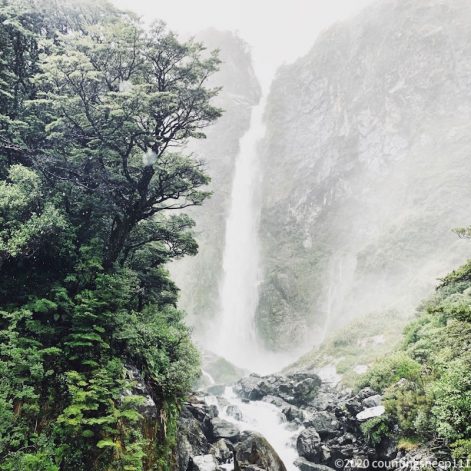
There was about 200mm of rain over the last 24hrs. Thus skipping the Mingha-Deception section of the trail as it would take another two days for rivers to come down. Now continuing tomorrow with the section after Bealy. Meanwhile, I walked around a bit in Arthur’s Pass and found some waterfalls. One of them being Devils Punchball with water falling 131m. Went for a beer (and ice cream sundae) in the evening with some fellow hikers.
04.02.2020 – Arthur’s Pass
Took the bus from Christchurch to Arthur’s Pass this morning. Leaving Christchurch in nice warm weather and now sitting at The Sanctuary at Arthur’s Pass in the worst rain and storm since I came to New Zealand. So happy to be not out there in one of the huts. In Fjordland National Park it’s even worse with tracks being washed out and trampers having to be helicoptered out. The Sanctuary is a nice little backpackers with a handful of other hikers around. Got also my last food parcel and now spend some time reading. Not much to do here ;). One of the two cafes is closed today. And as it is pouring down I’m not planning on leaving the hostel anytime soon.
03.02.2020 – Christchurch
Had a relaxing day at Christchurch today. Enjoyed some nice breakfast and coffee, went to get new socks, some more insect repellent and got a new bottle. Walked around in the city a bit, got an awesome gingerbread milkshake along with a cinnamon cookie and had some bread with fresh vegetables for dinner. Overall marking the most out of being in civilization ;). In the city the earthquake damages are still very obvious and a lot of construction is ongoing.
In the meantime, severe weather warnings have been issued for Arthur’s Pass and surrounding regions with heavy rain predicted for Tuesday. Happy to be not on the trail!
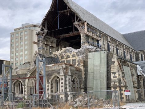
Damaged cathedral
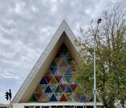
Cardboard cathedral
02.02.2020 – Trail Day 79
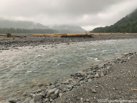
The day started with light rain and we left the hut at 7.30am as some river crossings were ahead. Walked together with two other hikers and we made our way to Taramakau River. Water level was a little up but crossing still possible. Stayed on the true left of the river and made our way through the valley. It was rough walking as major sections of the trail have been washed out and we had to walk in rocky riverbeds. After about 5km we could rejoin the marked trail and decided to attempt crossing Otira River as well. This was the shortest route to the state highway as we decided not to continue with the next section due to weather. All worked out and we arrived at the car park around 11.30am after walking 10km with rain becoming stronger. A car stopped within minutes and we jumped in. After a couple of kilometers we had cell phone reception and checked the weather for Arthur’s Pass: strong rain (60+mm) and storm predicted for Tuesday, so no way to attempt starting the next section, which requires good weather conditions. The couple mentioned that they are heading towards Christchurch, a 2hrs drive. And that the weather there is great. So we decided to stay in the car rather than get out in the rain at Arthur’s Pass. And after 2hrs on a very scenic road we got out at Christchurch; blue sky, 35 degrees Celsius :). So while severe rain is predicted around Arthur’s Pass there is supposedly a heat wave upcoming for other parts of the country. I have now booked for two nights at Christchurch and enjoy some city life – which basically means food :). Hope to be back on trail by Wednesday or Thursday, but let’s see.
01.02.2020 – Trail Day 78
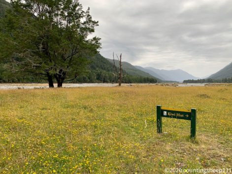
Today was 23km from Hurunui No 3 Hut to Kiwi Hut over Harper Pass (962m), a traditional route over the Southern Alps. After leaving the hut, first section of the track was nice and flat but muddy in places. Afterwards the trail ascended to Harper Pass, not too steep but some serious fighting thru bushes. After getting over the pass the track descended steeply until reaching Locke Stream Hut. Arrived there at 2.30pm and checked weather. As some rain is predicted and numerous river crossings are ahead, I have decided (along with two fellow hikers) to move on to Kiwi Hut. Luckily this was easier walking than expected and I arrived at the hut around 5pm. Now having a fire started and met some of the Canadian trail family again.
Some rock scrambling
Some bush walk
Harper Pass (962m)
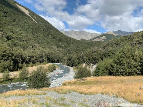
Taramakau River Valley
31.01.2020 – Trail Day 77
Walked from Hope Kiwi Lodge Hut to Hurunui No 3 Hut, about 27km. Left around 7.15am and arrived at 16.15pm, so not too late. Morning started with some drizzle and wind, later sun came out. First hour or so was walking in the middle of the valley before hitting the forest. Trail conditions varied quite a bit. From highway like forest path to jumping from mud hole to mud hole. Ended up in mud up to my knee a couple of times. But luckily could clean myself up during some stream crossings. Highlight of the day was taking a short bath in a natural hot pool. Felt so great sitting in there. Not so great was the sand flies attack after getting out of the water. Almost got eaten alive. Afterwards, following the track was a bit confusing. Ended up walking in the river bed a couple of times while the trail would go somewhere above in the woods. But as water levels are quite low, no issues staying at the bottom of the valley. Hurunui No 3 Hut is pretty old style but somewhat pleasant. Especially the bunks being spread across 3 stories are interesting. And the hut has broader mattresses :). Other than that one of my socks got holes. With that, pair number 4 on this trip is destroyed ;).
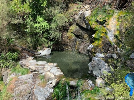
Hot Pool
Mud Pool
Hurunui No 3 Hut
Lake Summer
30.01.2020 – Trail Day 76
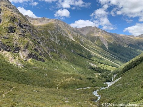
Walked from Boyle Outdoor Education Center to Hope Kiwi Lodge Hut, 27km. First 10km – the Tui Track – was somewhat ugly walking in high grass, mud holes, tussock, river crossings, stony riverbeds… – North Island style ;). Around noon the track merged with the Harper Pass track, which is far more enjoyable to walk. Long stretches in the forest and on open gras land next to the river. Nevertheless exhausting, especially since the backpack is filled with food again. Arrived at the hut shortly after five. The scenery throughout the day was nice but not not overwhelming. Some nice views on Hope Valley. But back to sunshine :).
29.01.2020 – Trail Day 75
First rain – well, little drizzle to be honest – since ages on the way from Boyle Flat Hut to Boyle Outdoor Education Center, a nice 12km walk. Again quite easy following the St James Walkway along Boyle River. Arrived there around noon, got a bed in a bunk room, took a shower, had a pizza – great :). And we got a surprise BBQ by a former TA walked who stopped on his way to make some TA hikers happy. That worked out pretty well ;). Besides, first time Internet since a week so doing my social media stuff ;).
Cloudy start in the day

28.01.2020 – Trail Day 74
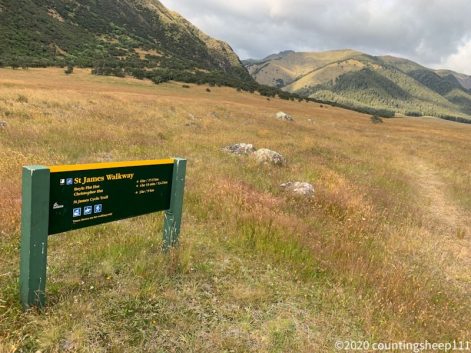
Continuing on the St James Walkway today from Anne Hut to Boyle Flat Hut. A nice 16km stretch along rivers in the valley for most of the day. A gentle climb across Anne Saddle (1147m) but all easy walking. Arrived at the hut already around 2pm and enjoying half a day off now ;).
27.01.2020 – Trail Day 73
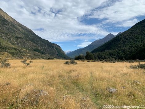
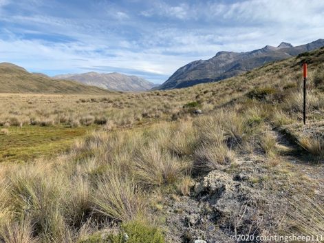
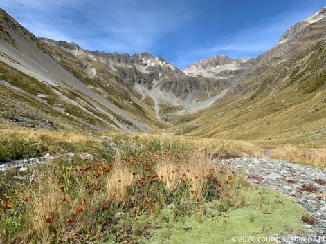
26km along Waiau River valley today to Anne Hut (following the Waiau Pass Track). Such nice walking along the valley next to the river. Almost just flat and an easy track. Felt so good after the last days. And it was probably the longest flat stretch without roadwalking so for on the trail. Also no need to carry much water as you could refill every couple of hundred meters out of the river or little streams. A couple of river crossing though which meant wet feet again. But all river crossing were pretty easy. Weather was a bit overcast but that was actually pretty nice as there was no cover walking along the valley. Anne Hut is also really nice. Very exposed with great views in the surrounding mountains. And pretty new and spacious. And no sand flies. Nothing compared to yesterday ;).
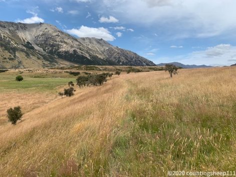
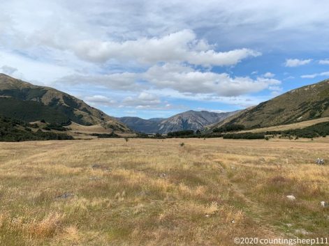
Quite a view from the hut
26.01.2020 – Trail Day 72
What a a day! Walked from Blue Lake Hut via Waiau Pass (1871m) to Waiau Hut today, 16km. The most exhausting day for me so far with about 10hrs on the trail and lots of uphill, downhill, and rock scrambling. But: the most spectacular views so far. Waiau Pass is definitely a highlight on the trail and marks the second highest point. The way up from Blue Lake Hut led to Lake Constance and then climbed to the saddle. So happy to be up there! From there it was a 1000m descent with some quite technical sections. The last three hours were smooth walking (after passing some boulder fields) along Waiau River valley. Felt so great strolling along the valley with no major climbs ;). But a couple of river crossings, this time got wet feet. And passed the 2000km mark of the trail :). The hut is this time smaller, 6 bunks (I was number seven to arrive and got the floor spot), and sand flies are a nightmare.
Waiau Pass ahead
Waiau Hut
Pass crossed
25.01.2020 – Trail Day 71
The day started with passing Traver Saddle at 1787m. Weather was a bit overcast but still great views on the mountains. Looks quite different than Richmond Ranges and mountains here are called alps for a reason. After the saddle a 1100m descent brought us to West Sabine Hut. This section took about 4.5hrs. As trail notes said 6-8hrs, this is not too bad. From West Sabine Hut the trail continued along the river and this section faced some wash outs. DOC just finished
some clean up of the track, but was rough in places nevertheless. Took 3hrs to reach Blue Lake Hut (and trail notes said 3hrs, so this time pretty accurate). The hut (16 bunks) is pretty full tonight and located next to Blue Lake, the cleanest freshwater lake in the world.
Blue Lake
Sabine River
24.01.2020 – Trail Day 70
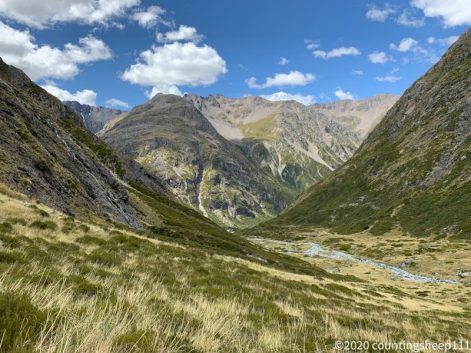
Today was a 20km hike from Lakehead Hut to Upper Travers Hut via John Tait Hut for lunch break. The first couple of hours went along Travers River valley without much incline. Afterwards the track ascented towards Upper Travers Hut (1340m), overall about 1000m climb. The track was fairly easy with some washed out sections. But so far not at all comparable to the scrambling required in the Richmond Ranges. During the last couple of hundred meters towards the hut some impressive views on the southern alps opened up. And the hut itself is sitting right at the foot of a mountain within an amazing scenery. The hut is again pretty big with 24 bunks but not too crowded. On the way up I did also go to see Travers Falls, a really nice waterfall.
Hut with a view
Upper Travers Hut
Travers Falls
23.01.2020 – Trail Day 69
Continued from St Arnaud to Lakehead Hut today, 11km along lake Rotoiti. It was only 3hrs of walking and I had plenty of time to enjoy a nice breakfast and stop at the DOC center to check out trail conditions. Looks like weather will be good. But some parts of the trail have been washed out and it takes additional time to walk. Let’s see. The Lakehead Hut is huge, 28 bunks. But we are only two people at the moment. The track to the hut went along the lake. It was a nice path in the shade, enjoyed it especially as it is very hot today.
Lake Rotoiti
22.01.2020 – Trail Day 68
Today was the last day in Richmond Forest Park. I walked out to St Arnaud, overall 21km. This team really easy tracks and the last 8km on the road. There was no climbing over rocks or crossing rivers and I arrived at St Arnaud around 1.30pm. But nevertheless some nice views on the Wairau Valley and on some snow covered of the Southern Alps. Checked in at the Alpine Lodge and picked up my first food parcel. Definitely nice to be back in civilization where you can order a real coffee after eight days in the mountains. These days have been quite challenging and exhausting. But definitely the most impressive section of my journey so far. Just had some ice cream and tonight will enjoy a real dinner. And had a nice hot shower, and will sleep in a proper bed. Not more needed to be happy :).
21.01.2020 – Trail Day 67
Short day today from Porters Creek Hut to Red Hills Hut, 11km. Meanwhile summer has come to the South Island. It was again a hot day and I was so happy to walk only for 5hrs. Trail was a mix between rock hopping, walking in river beds, and bush walk. Arrived at the hut at 2.30pm and enjoying some “free time”. Last meters to the hut went thru some tussock with a bit of mud. But still no wet feet ;).
20.01.2020 – Trail Day 66
17km today from Top Wairoa Hut to Porters Creek Hut, about 10hrs on the trail. And the sun was burning. Almost all parts of the trail were above the bush line or in light forest and I drank more than five liters. First trail part from the hut was a steep ascent across a boulder field, quite hard work. After that was some ridge line walk with nice views (and cell phone reception). Afterwards the landscape changed as we were entering the Red Hills. We had to slide through gravel, scramble over more boulder fields, climb some hills, and cross some rivers (advantage of hot weather: low water: dry feet). Looked like walking on a different planet. First time on the Richmond Alpine Track we could see the hut already from a distance. Thirty more minutes of walking thru some swampy grass and we arrived after a long day. And crossed the 1900km point today :). But my feet are somewhat bothering me. After the last days went well, I need to some taping for the section tomorrow I guess.
Porters Creek Hut
Red hills in the afternoon. Looks like different planet.
Way up from hut Top Wairoa Hut
First ridge in the morning
19.01.2020 – Trail Day 65
From Tarn Hut we walked via Mid Wairoa Hut to Top Wairoa Hut, about 14km and 8hrs of walking. First couple of hours was a mostly downhill with the last couple of hundred meters being quite steep. We reached Mid Wairoa hut after crossing a swing bridge and had some first views on Wairoa River. From there on the track became more challenging as we were following Wairoa River upstream for 7km. We crossed the river multiple times but due to dry weather we could hop from stone to stone and kept dry feet. The track was quite rough in parts with humbling over trees and scrambling around rocks. To quote the trail notes: “Some trampers will find this section challenging.”. Walking along the river we saw some waterfalls and enjoyed idyllic views now and then. Rather exhausted we reached the hut around 4.30pm. The hut stands right at the bush line with some nice views on the Red Hills.
18.01.2020 – Trail Day 64
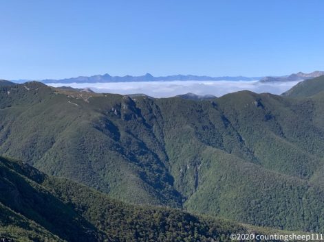
Today was the most challenging section of the Richmond Alpine Track (according to trail notes) with summeting Mt Ritoul (1731m) and Little Mt Ritoul (1643m). But also the day with the most spectacular views on the whole TA so far. We started early and had some great views above the clouds. It was quite a climb from the hut back to the trail. Afterwards there was some serious scrambling across rocks and walking on gravel with some exposed sections. Quite exhausting and we had an extended lunch break after 5hrs at Mt Rintoul Hut before moving back into forest on the way to Tarn Hut. One short section went again above the bushes up to Purple Top, and then we followed the ridge down to the hut next to a lake. Overall it was 13km with 1500m ascent and 2000m descent and 9.5hrs from Slaty Hut to Tarn Hut. Have decided to pitch my tent as the hut is full and would have had to sleep on the floor anyways. In the tent there is at least no snoring and there is plenty of fresh air. Hope the little Weka family doesn’t want to join…
Mt Rintoul summit
17.01.2020 – Trail Day 63
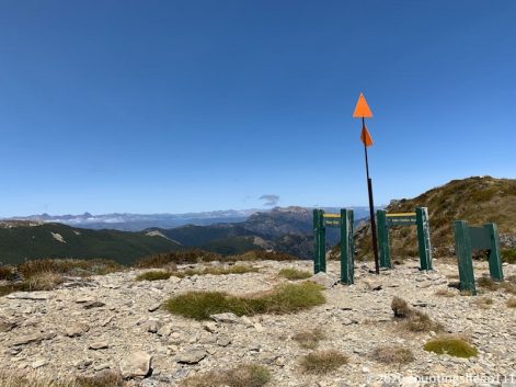
Did a short day today from Slaty Hut to Old Man Hut, about 10km and 4hrs walking. Arrived at the hut 2.30pm and enjoy sitting around with a fellow hiker. The hut even has new mattresses :). The track today was along a ridge and almost all the time above bush line. We had some great views on surrounding mountains and took many photo stops along the way. We were walking above the clouds and could see clouds slowly being blown over ridge lines. The trail involved some scrambling but was all well doable especially given the very good weather. The final descent to the hut was quit steep though.
16.01.2020 – Trail Day 62
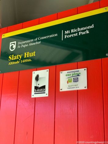
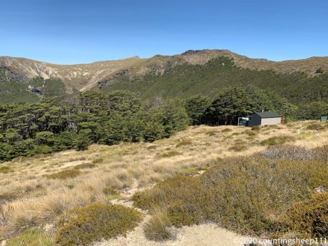
Today was a 11km day with 1500m ascent from Hacket Hut to Slaty Hut – the first section of the Richmond Alpine Trail. Arrived around 4pm. The day started with some back and forth crossings of Hacket Stream (no wet shoes!). The following uphill section was a pretty well formed track and brought us to Starveall Hut for lunch break. From there the track continued along the ridge line above bushes with great views across the South Island and involved some scrambling along a poled route. Shortly before reaching Slaty Hut the trail went through some beautiful forest. Slaty Hut at 1400m is located at the bush line and there are some nice views. It’s a 6 bunks hut and we will squeeze in 9 people tonight.
15.01.2020 – Trail Day 61
Today was 20km from Middy Hut to Hacket Hut via Rocks Hut and Browning Hut. The track got a bit rougher and some climbing over fallen trees was necessary in places. At the end some hopping back and forth across a stream but so far no wet shoes. This will change tomorrow ;). Today I got some views as for about a kilometer the track followed a ridge line above the bushes. Great views on various mountain ranges and again amazing weather. Arrived at the hut around 4.30pm and continue eating nuts to reduce weight of my backpack. Water supply is again a river next to the hut which is also well suited for some washing ;).
14.01.2020 – Trail Day 60
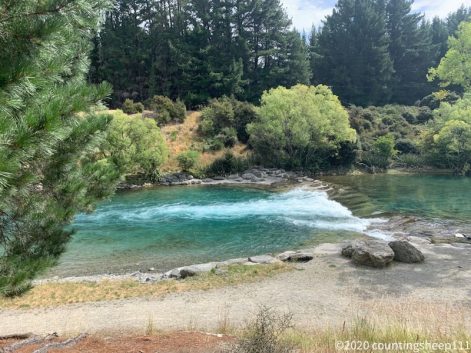
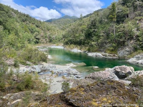
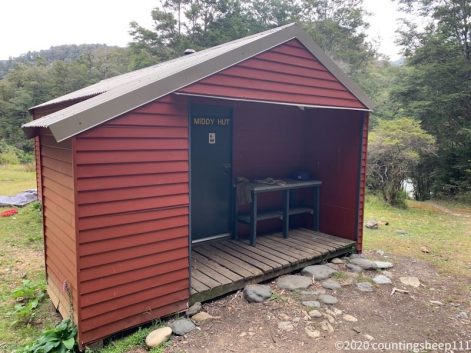
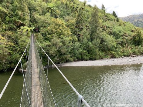
Walked from Pelorus Bridge campsite to Middy Hut, about 28km. Quite a long day with a heavy backpack stuffed with food for 11 days, just in case… But I am feeling surprisingly well after the walk :). The day began with 14km of (gravel) road walking before the Daltons Track started. This track was nice walking along the Pelorus River thru nice forest with three river crossings on somewhat scary swing bridges. The track has quite some up and downs but no major climb and I enjoyed it a lot. Finally no muddy forest walk :-D. Reminded me on tracks in the alps. Was around two at Captains Hut to fill up water and then decided to move on to Middy Hut. Arrived at 4.30 and got a bunk (only six bunks here). And ate lots of nuts to reduce the weight of my backpack. Additionally lost my drinking bottle – even more weight reduction ;). The hut is right next to Pelorus river which is great for refreshing. But there are millions of sandflies.
13.01.2020 – Havelock
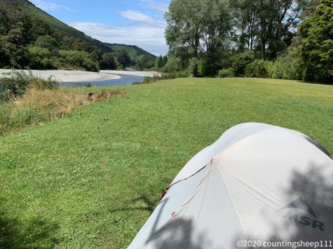
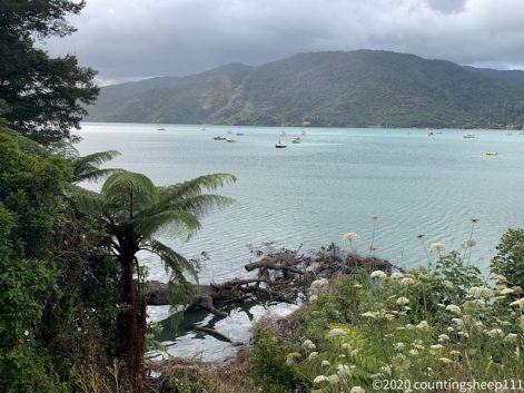
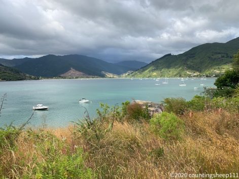
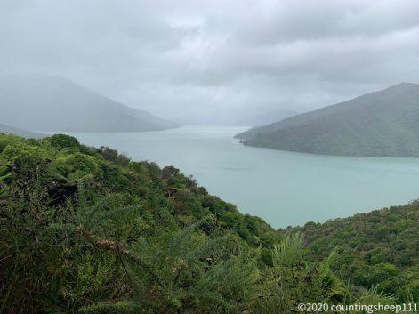
Had a relaxed start into the day which was starting grey and rainy. Decided yesterday to hitch to Pelorus Bridge as it would have been a 20km road walk. Have spent the morning in a nice cafe and met some TA walkers. Later caught a ride after waiting for only 15min to Pelorus Bridge where I have pitched the tent at a nice campsite next to the river. Was the last day in civilization for quite some time…
12.01.2020 – Trail Day 59
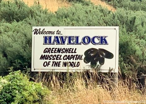
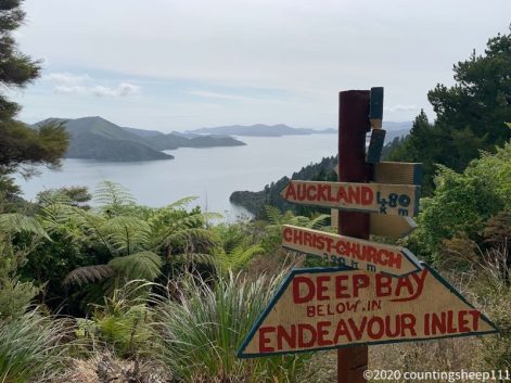
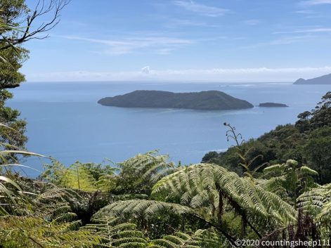
Completed the Queen Charlotte Track (ends at Anakiwa) and walked on to Havelock, the world capital of the greenshell mussel. Trail had some road walking but most parts where a little pathway running parallel to the road (the Link Pathway). Last section would have had some great views but the weather was not too nice. Some drizzle, bit windy but also mixed with sun. Today was about 21km. Had a coffee and cheese scone stop at the Queen Charlotte Tavern before making my way into Havelock where I am staying at a hostel. Went shopping resupplies for 11 days – the backpack will be heavy. And enjoyed an early greenshell mussel dinner. Mussels are still not my favorite food and the greenshell mussel capital of the world didn’t really change this ;).
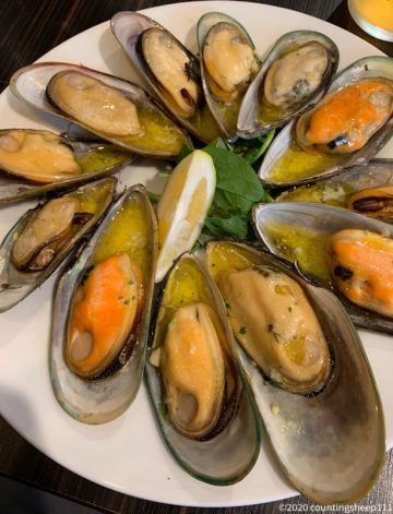
Dinner
11.01.2020 – Trail Day 58
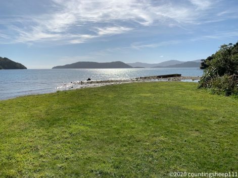
Third day on Queen Charlotte Track took me from Cowshed Campsite to Davies Campsite, just shortly before Anakiwa where the track ends. The day started with a steep climb from sea level up to the ridge at 400m. Afterwards it was moderate ups and downs with again nice lookouts. Around noon I took a 30min detour to Mistletoe Bay just to get some coffee and ice cream – totally worth it :). Overall distance today was about 22km with about 800m ascent/descent. Arrived at the camp around 3.45pm which gives some time reading trail notes and sewing my backpack. The stitching of the shoulder strap is about to fall apart…
Lunch break 😉
10.01.2020 – Trail Day 57
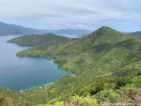
Second day on Queen Charlotte Track was about 25km from Camp Bay Campsite to Cowshed Campsite. Again very easy walking but some more uphill and downhill sections. And again nice weather with amazing views on the Marlborough Sounds. Made it to the camp by 4.15pm. As yesterday, many Weka birds are around which supposedly steal your things. This means all small items go in the tent. And let’s hope they are not trying to drag my backpack into the bush ;).
09.01.2020 – Trail Day 56
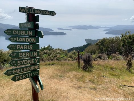
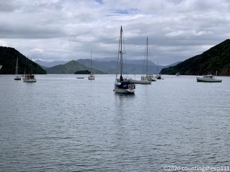
Hiked the first section of the Queen Charlotte Track from Ship Cove to Camp Bay campsite, about 29km. What a gorgeous start for the South Island! A sunny day and stunning views along the track. The track itself is easy walking. Was nevertheless a longish day starting with 1.5hrs water taxi ride from Picton to Ship Cove. Made it to the camp by 5.15pm and feel like heading straight to bed (jetlag is also still somewhat bothering me). But walking does still work after the extended break ;).
Ship Cove
08.01.2020 – Wellington / Picton
Back in New Zealand. And now it’s time to discover the South Island. After coming back from Thailand I’ve spent two days planning the next section of my hiking adventure. The South Island has far less civilization and the trail does not lead through many towns for the first part. That’s why I’ve invested about NZD$1000 in resupplies and sending ahead three boxes with food for 2×7 and 1×4 days. Boxes go to St Arnaud, Boyle Village, and Arthur’s Pass. Over the next four weeks this will hopefully be sufficient to keep me going without the need for any major detour to go shopping. Let’s see – somehow feels weird posting parcels addressed to oneself containing lots of food.
This morning took the Interislander ferry to Picton. Quite an impressive landscape the ship goes through. Unfortunately it’s not quite summer here today. So pictures are a bit greyish ;). Currently enjoying some real food and coffee as next weeks this will be a luxury. Tomorrow morning catching a water taxi to Ship Cove where Te Araroa starts with the Queen Charlotte Track. Let the adventure continue!
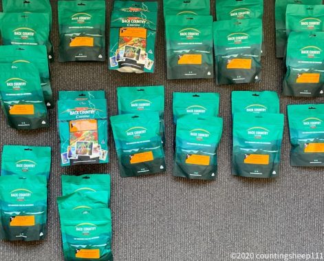
Dinner for four weeks 😉
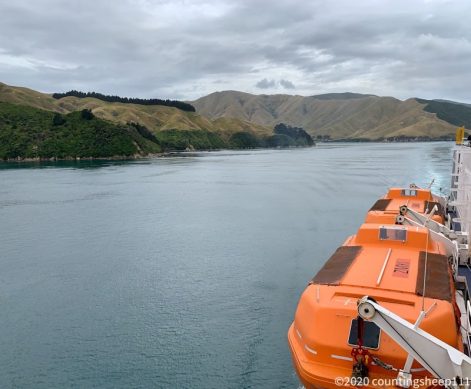
Approaching South Island
Picton
28.12.2019
Taking a break from hiking. Happy holidays :).
23/24.12.2019 – Wellington
22.12.2019 – Wellington
Went to the Te Papa Tongarewa / Museum of New Zealand and got a hair and beard cut. Slowly getting used to civilization ;).
21.12.2019 – Trail Day 55
That’s it for Te Araroa in the North Island! Walked the last 11km today and took the bus back to the YHA Wellington. Feels amazing to have this part of the journey completed :). The last kilometers today went over some hills following the Southern Walkway of Wellington. No mud, no bushwalk, no river crossings ;).
Statistics North
As today concludes the North Island, I did some rough statistics about my journey on the TA so far. The official route of the trail 2019/20 on the North Island is 1695km long. Out of those I walked about 1105km. Took the bus for 265km (Auckland-Hamilton, Whanganui-Palmerston North). Hitchhiked about 55km (Waipu-Waipu Cove, Timber Trail trailhead-Taumarunui, Tararua Forest Park-Paraparaumu). Did kayak 23km (Pahia-Waikare, Puhoi-Wenderholm). Did canoe for 225km (Taumarunui-Whanganui) with 120km directly following the trail. Skipped 120km of walking on trail in favour of a longer canoeing journey (Taumarunui-Owhango, National Park-Mangapurua). And took boats to cross harbours or estuaries 3 times (Devonport-Auckland, Whangarei Heads-Marsden Point, Ngunguru). Overall 55 days of walking with an average of 20km per day of walking. Replaced one pair of shoes and 3 pairs of socks.
20.12.2019 – Trail Day 54
Arrived at Wellington! Although it’s not the end of the trail on the North Island yet it still feels great. It’s only 10km of trail left and that will be walking without the big backpack. This morning was quite stormy again and I was happy not to sleep in a tent. Around nine sun came out and conditions were good to go on the last kilometers towards Wellington. Trail went first to Mt Kaukau (445m) before following a ridge and descending down into Wellington botanical garden. There were a couple of steep sections but the track itself was easy walking. Also picked the parcel I had sent ahead from Kaitaia. Now I have a new pair of shoes and can decide upon which pair to use for the South Island. Bumped into a couple of fellow hikers also staying at the YHA and we went out for dinner and some beers (and milkshake).
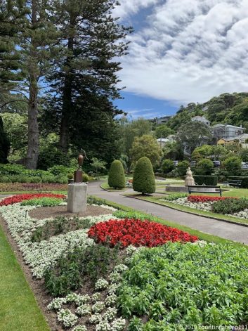
Wellington botanical garden
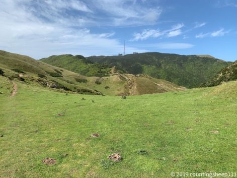
Mount Kaukau
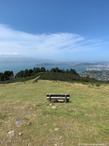
Wellington
19.12.2019 – Trail Day 53
Slowly approaching Wellington. Today was a 25km walk from Plimmerton to Johnsonville. Crossed the Colonial Knob (468m) and had some nice views on the area. The tracks were quite easy, no mud, no crawling over trees. But many stairs up to Colonial Knob. And some road walking again… Weather in the morning was sunny, in the afternoon it became windy and cloudy. Staying at a trail angel tonight before making my way into Wellington tomorrow.
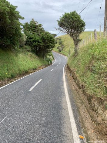
Finest New Zealand road walk… 😉
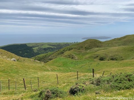
Views from Colonial Knob
18.12.2019 – Trail Day 52
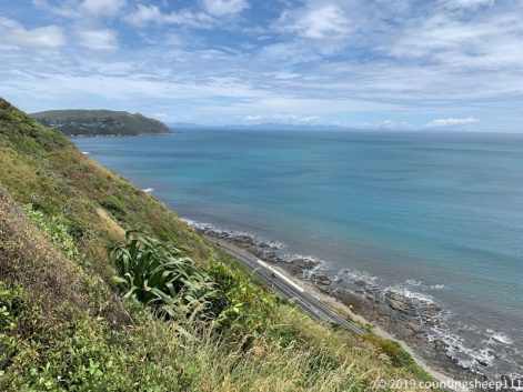
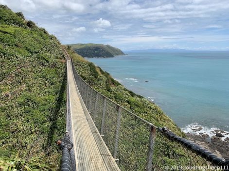
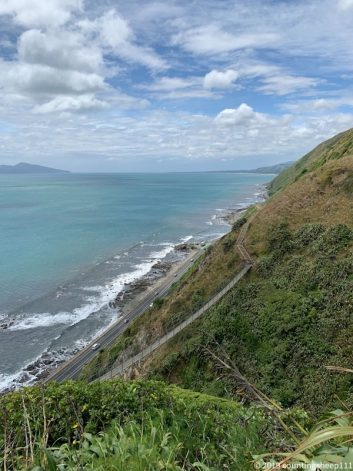
After a very rainy and stormy night in the tent I continued walking around noon. Weather cleared up by then and I started with the Escarpment Track. The tracks follows the coastline high above beach, state highway and railway. The track is 10km and includes stairs with over 1100 steps in total and two swing bridges. It connects Paekakariki with Pukerua bay and provides some spectacular views. Afterwards was walking a simple pathway along the state highway to Plimmerton where I’m staying at an Airbnb place with nice hosts, overall 18km.
17.12.2019 – Trail Day 51
After a very relaxed start into the day I walked from Paraparaumu to Paekakariki (12km) and pitched my tent at the holiday park. First kilometers was beach walking before I went on the street as high tide came in. It started to rain in the afternoon but it’s not cold. So there is nothing to complain about ;). Spent some time at a cafe and arranged accommodation for the next week or so. Wellington and Christmas Break is coming closer :).
Back on the beach.
16.12.2019 – Trail Day 50
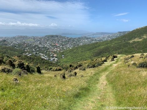
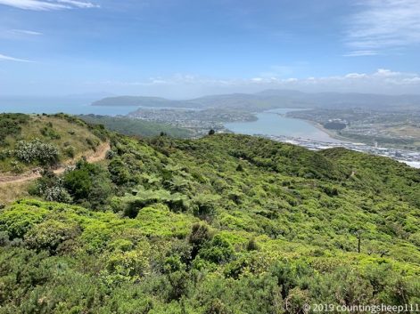
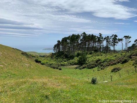
Made it out of the Tararuas – yeah! The hardest section so far. But also the most impressive scenery and some walking above the bush line along exposed ridge lines. Today the Pukeatua track – about 14km – was the last part before leaving Tararua Forest Park. Was a nice bush walk along the ridge line but without much views due to clouds. But the misty forest was also very nice to watch. At the end of the track we got a ride into Paraparaumu (including cold drinks and cookies – heaven!) where I’m staying at a trail angel whom I met two days ago at the hut. The hospitality here is so great and I am now just enjoying that I had a hot shower and can sit on the couch :).
15.12.2019 – Trail Day 49
Walked 10km from Waitewaewae hut to Parawai Lodge hut. First 5km was somewhat exhausting bush walk again with climbing over roots and trees. Afterwards the trail became much easier going and we arrived at the hut shortly before 4pm. Had to search a bit for the hut. Trail was not marked too well ;).
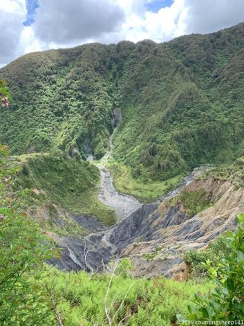
Quite a landslide
14.12.2019 – Trail Day 48
Today the ridge walk continued over Mt Crawford summit (1462m) towards Waitewaewae hut. Unfortunately the weather did not allow for many nice views. Walked within the clouds until we went into the bush again. And it was pretty stormy up there (weather forecast called it “A few morning and evening showers, but afternoon fine breaks. Gale northwesterlies at times.”). The trail was quite alpine again with some sections of scrambling around rocks. After a long descent from 1400m to 300m we arrived at the hut around two, 7hrs of walking for 8km.
Final meters towards the hut
13.12.2019 – Trail Day 47
About 9hrs of walking today for 12km. The trail is following a ridge line, so many ups and downs and amazing views of the Tararua ranges. The terrain is quite alpine (finally) so not too much fighting thru bushes. Lunch break was at Dracophyllum hut, a little hut sleeping 2 people. We then moved on to Nichols hut. Supposed to sleep 6 people, but we squeeze in 9 tonight. Weather was quite good, some walking in the mist and clouds in the morning and quite windy during the last hour.
Nichols Hut
12.12.2019 – Trail Day 46
Today entered the Tararua ranges with a quite exhausting 14km walk and climbing 1300m. Got dropped of in the morning by our hosts and started walking where we left the trail yesterday. Whole track is a nice bush walk with pretty views on Tararuas and the ocean. Arrived at Te Matawai Hut in the afternoon and I’m feeling like spending the whole evening eating ;).
11.12.2019 – Trail Day 45
Today was 21km along the Mangahao-Makahika Track. A very nice bush walk with quite some muddy sections. But also some stream crossings so that shoes are clean by the end of the day. On the way we had quite a view on Mt Taranaki and Mt Ruapehu. We had to go off trail for doing resupply then after the track. Luckily we got offered a ride into town at the intersection towards Levin. And not just that: we also got offered to stay with the family and three kids, had dinner together, a hot shower, and got a ride for grocery shopping. Such a great hospitality! This surely is an unforgettable moment of my journey.
10.12.2019 – Trail Day 44
A short day today walking the Burttons track to Tokomaru shelter – about 15km. Due to need for resupply tomorrow it didn’t make much sense to continue walking. The track was a very enjoyable bush walk including crossing some streams. Weather is back to summer – blue sky, some decorative clouds.
Burttons Track
09.12.2019 – Trail Day 43
After quite some time sun is back and I am back to walking. Today about 30km from Palmsteron North to the Motorimu shelter at Gordon Kear Forest. Teamed up with another solo hiker for the next couple of days. Today’s section was nice, some little hills and good walkways through forests. Enjoyed it very much. At the shelter about 20 other TA hikers are staying. All starting again today after some bad weather the last week. And it’s time to celebrate crossing the 1500km mark of TA!
Quite busy at shelter
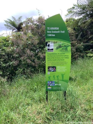
1500km mark
08.12.2019 – Palmerston North
A very rainy day which I have spent going to Palmerston North by bus before starting the next section of the trail under better weather conditions hopefully. As some river crossings are upcoming, more rain could also make this impossible. But let’s see. Walked around a bit in Palmerston (aka Palmy) and went to the concert of Mickey and Michelle (https://www.mickeymichelle.com) in the evening; two musicians also walking the TA. Enjoyed it very much, great performance :).
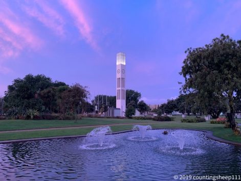
07.12.2019 – Wanganui
Spent another day at Wanganui to do some laundry and to enjoy civilization ;). Took an elevator up to Durie Hill and checked in at YHA afterwards. Will be taking the bus to Palmerston North tomorrow.

Street art in Wanganui
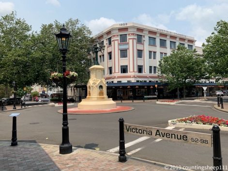
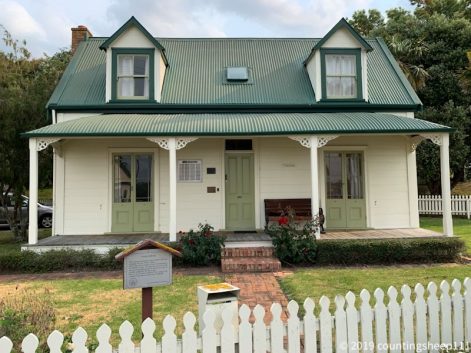
Tylee Cottage
06.12.2019 – Canoeing Whanganui River Day 7
Finally arrived at Wanganui after 4hrs of paddling. Perfect weather and calm river. Got greeted by a steam boat going along the river. That’s how it used to be in the old days where Hipango Park was a popular steam boat landing. After arriving at Whanganui and getting barrels unloaded and backpack loaded we walked for an hour to meet our wonderful trail angels hosting us for the night. We have been welcomed with a Maori ceremony, a very personal and unique experience. This concludes the canoe adventure on the Whanganui River (which btw is also one of New Zealand’s Great Walks). Overall about 165km.
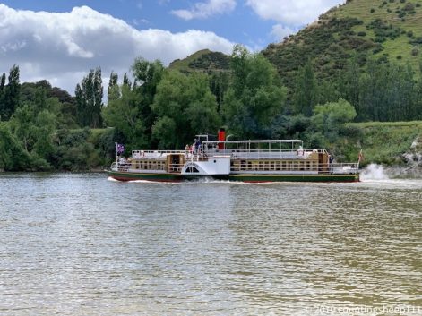
05.12.2019 – Canoeing Whanganui River Day 6
We had a late start today from campsite and could dry most of our stuff. Paddling today was not too exciting as we are getting closer to Whanganui and the river becomes wider. Nevertheless a nice day on the water without rain. After about 6hrs of paddling we have arrived at Hiponga Park campsite.
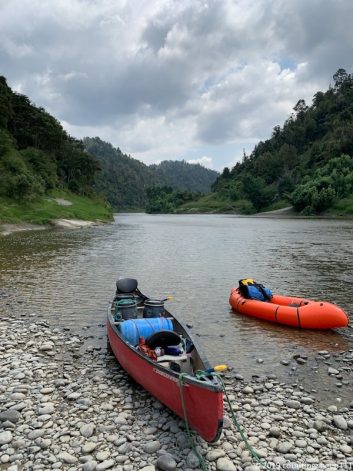
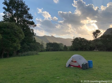
Hiponga Park campsite
04.12.2019 – Canoeing Whanganui River Day 5
We had a long day of canoeing today from Ramanui campsite to Flying Fox campsite – about 50km, 8hrs of paddling. At Pipiriki our group split up and we are now three people continuing towards Wanganui. Today was luckily sunny again. There were some nasty rapids and we capsized once (this time not bring me the guy sitting in the back steering 😉 ) and got all wet. Now after dinner and pitching the tent I’m feeling ready for some rest.
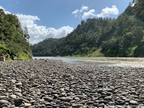
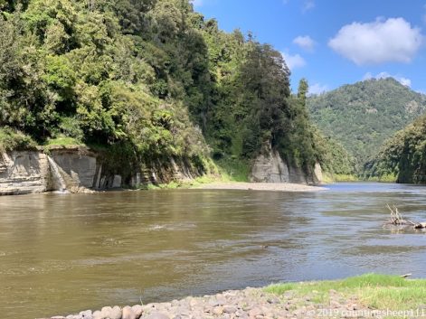
03.12.2019 – Canoeing Whanganui River Day 4
After having a good sleep at the hut (school class was not partying 😉 ), we did start around 8. Little later rain started and it kept raining until late afternoon after our arrived at Ramanui campsite. River went up a bit, but not significant change in terms of rapids and current. Around lunch time we arrived at Mangapurua campsite. After tying the canoe to many other canoes we took a walk to the Bridge to Nowhere. The bridge has been built prior to the road. Just the road got never built. Afterwards was quite easy canoeing, however in heavy rain. At the end we missed the Ramanui campsite landing and ended up about 200m further down stream. Luckily our barrels got transported from there to the campsite. But we had to first paddle to the opposite river bank upstream. Then pulled up the canoe some more meters and had a second attempt to reach the landing (this included having the canoe facing upstream and going backwards). Finally made it and got an upgrade to a cabin instead of having to put the tent up in heavy rain. And there was a hot shower. And a beer at the lodge next to the campsite. So all you need after such a day ;).
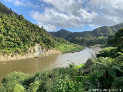
Ramanui campsite
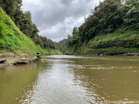
On the river
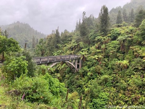
Bridge to nowhere
02.12.2019 – Canoeing Whanganui River Day 3
A relaxed day of canoeing to John Cuoll had we are sharing with a school class from Australia. Let’s see how the night goes ;). We had some showers during the morning but evening was nice and tent could almost dry up. The canoeing was not so challenging today and we arrived at the hut around 3pm. The river flows thru a canyon for many parts of the section we paddled today. Many little water falls appearing to the left and right. Stones covered with green plants. It felt like paddling in the jungle. Although many goats are sticking around at the riversides.
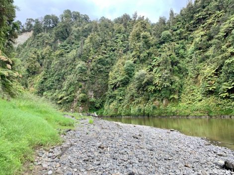
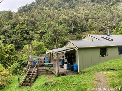
Hut
01.12.2019 – Canoeing Whanganui River Day 2
We had some rain over night and the river went about about half a meter. This was actually a good thing. Less rocks sticking out of the water. Most obstacles have been trees. We paddled for around 5 hours to reach Mangapapa campsite at 3. Although there have been the one or other rapid, we did not capsize. Just figured out that higher speed helps getting thru more safely :-D. It allows for better control over the boat. And you ride on top of the waves. Great experience! Nevertheless there was some water in the canoe afterwards ;).
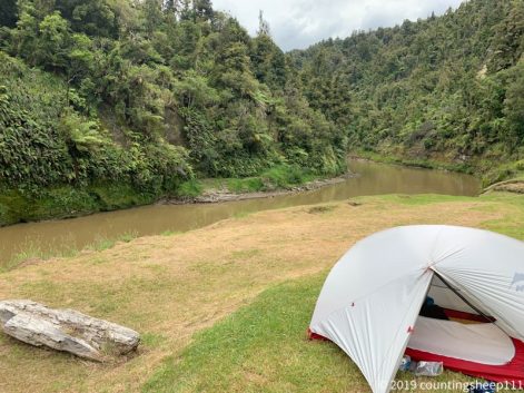
Mangapapa Campsite
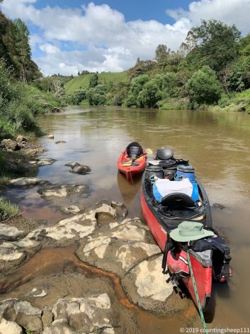
Lunch Break
30.11.2019 – Canoeing Whanganui River Day 1
Started our canoe adventure towards Wanganui at 9.30. The first four days are actually one of New Zealand’s Great Walks. I am in a two person canoe sharing it with a German girl. And got the back seat which means I need to steer. The river is quite low which makes it not too easy to canoe. Some rocks stick out. And there are some grade 1-2 rapids along the way. Took us about one hour until we got pushed against one of the rocks while being inside one of the rapids. We did not really capsize but the boat got filled up with water. We had to get out and work for 20min to get the boat away from the rock and on the side of the river to get water out and things sorted. Almost lost one paddle, but luckily another person in the group had caught it a bit down the stream. Rest of the day and the other rapids went well. Was also really sunny besides a little shower at Poukaria Campsite where we arrived around 5pm.
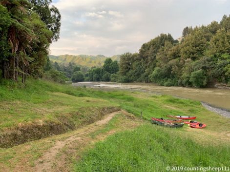
29.11.2019
Today was mainly grocery shopping at Taumarunui. Next eight days will be canoeing down Whanganui river without cell phone service.
28.11.2019 – back to Taumarunui
Next is figuring out canoeing down Whanganui river. I got a ride back with the canoeing company to Taumarunui today. Just set up my tent on their properties, will resupply tomorrow and most likely start canoeing Saturday. Overall a no-walking but drinking-coffee and do some reading day. Very relaxing 🙂 (besides the jet boat ride we got offered in the afternoon by the canoeing staff – that was quite thrilling).
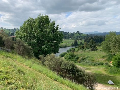
Camp spot next to Whanganui River
27.11.2019 – Trail Day 42
After 11km of easy walking along the 42nd traverse I did arrive at Owhango. Well, the plan was to have some nice lunch there and figure out the details for the next section including canoeing down Whanganui river. The only cafe was closed. There was no cell phone reception. One motel was fully booked. The other place closed for renovation; this place also is supposed to offer canoeing, waited there for 1.5hrs but nobody showed up. Then decided to hitchhike to National Park again and staying at the YHA. Met a couple of TA hikers from the first days and we had some nice dinner and beers.
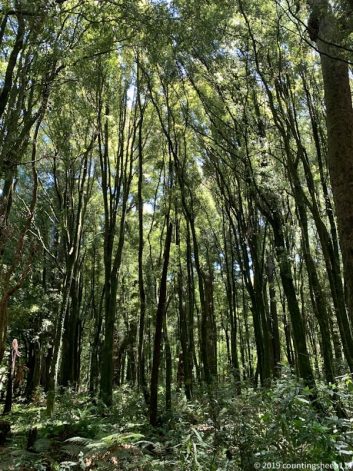
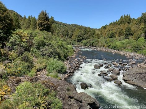
Whakapapa River
26.11.2019 – Trail Day 41
After walking 27km a pitched my tent somewhere on the 42nd Traverse Track about 10km in front of Owhango. It was again a hot and sunny day. First part of the section today let to Te Porere where remains of two redoubts are situated along the track. Afterwards the Waione Cokers Track started: a somewhat muddy experience but luckily with some fairly easy river crossings. This meant clean shoes at the end ;). This part of the track has some slippery and steep sections but was overall not too hard to walk. On the last kilometers on 42nd Traverse Track were some nice views on surrounding forests.
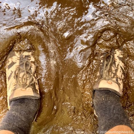
Start of Waione Cokers Track
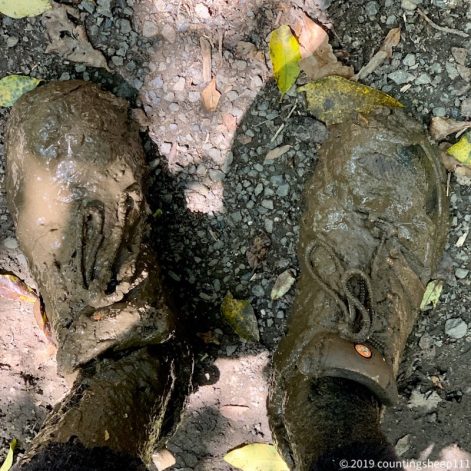
During Waione Cokers Track
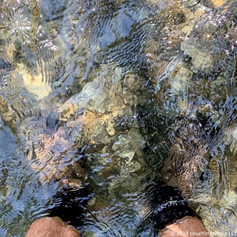
After Waione Cokers Track
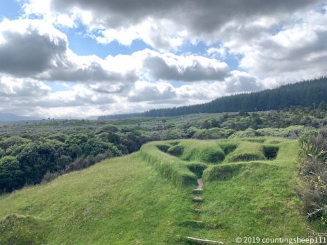
Te Porere redoubt
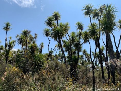
Some palms along Waione Cokers Track
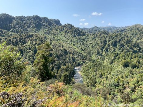
View from 42nd Traverse Track
25.11.2019 – Trail Day 40
Today was 25km of walking and doing the famous Tongariro Alpine Crossing. That’s a quite popular hike and there were probably as many people on the track as I have seen the 39 other days on trail altogether. I did start early and went up to red crater with the sun rising in front of me. It’s really some spectacular views of a surrealistic landscape. The trail itself had a couple of steep climbs but was mostly easy to walk. Just descending from red crater was a bit slippery due to gravel. The descent after red crater had also some nice views and was somewhat longish on well maintained pathways. As I’m going north bound currently I bumped into some other TA hikers I met at the very beginning of my journey. Last 7km was road walking to Tongariro holiday park.
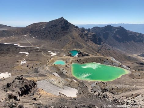
The obligatory Tongariro Crossing pic
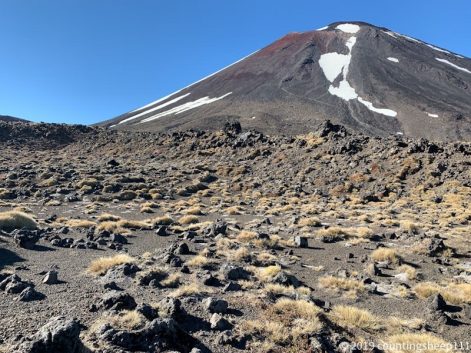
Mount “Doom”
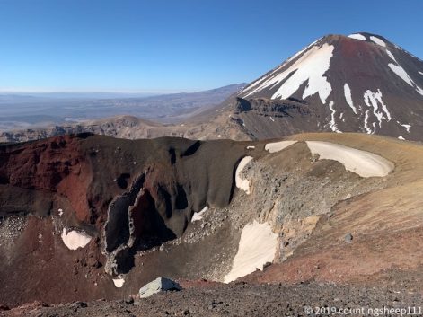
Red Crater
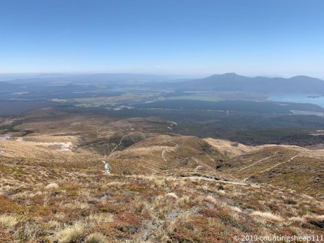
Way down…
24.11.2019 – Trail Day 39
Left the hut around eight and crossed the river again. This time a different spot, was not that scary anymore – but maybe the trick is getting some practice ;). Afterwards followed the trail to Whakapapa with a short detour to Silica Rapids. Crossed again (!) Whakapapaiti river – this time via a bridge though ;). After a coffee and a smoothie I started the next section to Mangatepopo hut, situated right at the beginning of Tongariro Alpine Crossing. Took also another short detour to see Taranaki Falls. Overall about 25km, all on trails – no roads *yeah*. Trails were mostly in good conditions and well marked. Just did set up my tent with a view on Mt Doom ;).
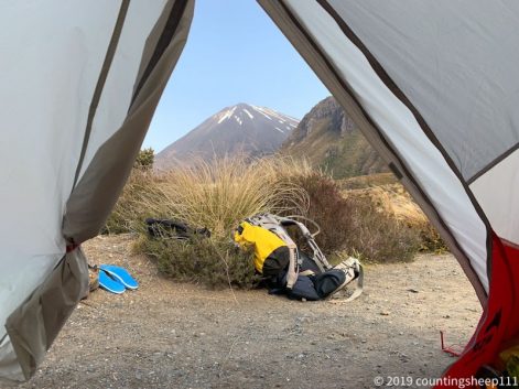
Tent with a view
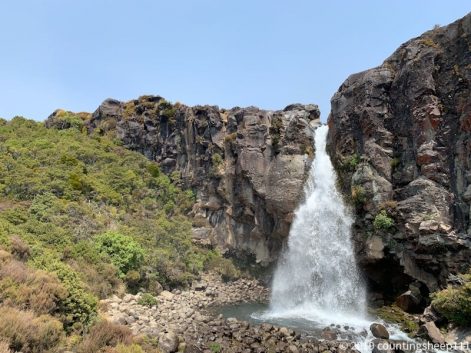
Taranaki Fall
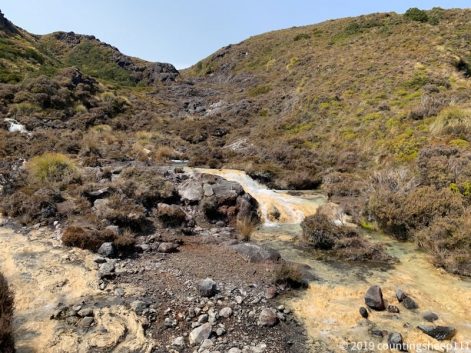
Silica Rapids
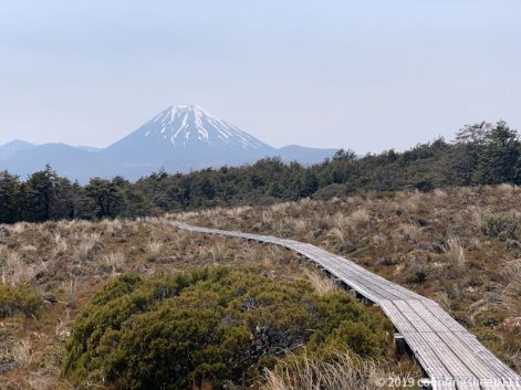
Ever wondered how the path to Mordor looks like? Well – it’s a wooden walkway.
23.11.2019 – Trail Day 38
Back to hiking! Arrived around 8 o’clock in the morning at National Park village. After about 5km road walking I hit the Mangahuia track walking towards Whakapapaiti Hut at 1250m. Track was nice with amazing views on the mountains. Muddy in places and felt like walking in a swamp from time to time. Could be something like a “Hochmoor” up here. Shortly before reaching the hut there was like the first real river crossing. With snow melting in the mountains, Whakapapaiti stream had quite some water flowing down. Was a bit deeper than knee height and I used my poles to lean against the current. Worked out but was nevertheless somewhat challenging. Arrived at the hut around 2pm and enjoying reading a book while sitting outside in the sun in front of amazing panoramic view on the snow covered Tongariro mountain range. No other TA hikers around (hut is a bit off trail) but quite a couple of locals (as it is Saturday) arrived. The stream nearby is good for refreshing and cleaning muddy legs ;). Distance today was around 15km.
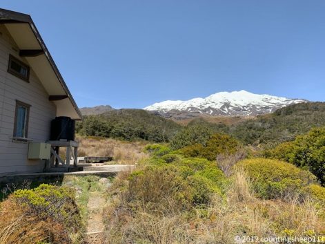
Hut with a view
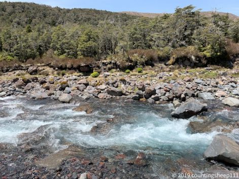
River crossing
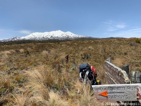
Lunch break
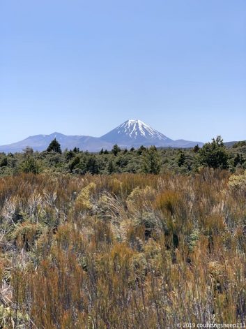
22.11.2019 – Taupo
Today is a relaxed day at Taupo. Enjoying a coffee while sitting in the sun. Downloaded some new books and got food for the next couple of days on the trail. Tomorrow morning will be an early start towards National Park village. Afterwards I plan to head to Whakapapaiti Hut. The hut is not directly on the TA route, but looks like a nice place for spending the night before heading onwards to Mangatepopo Campsite and doing Tongariro Crossing Monday.
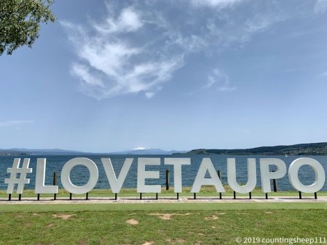
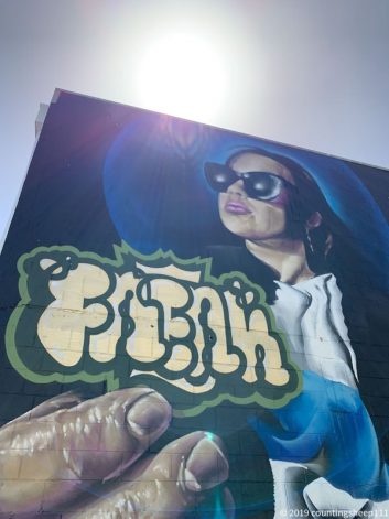
Street art in Taupo
21.11.2019 – Taupo
Summer day in Taupo! After arriving, having lunch, and checking in at YHA I walked to Huka falls. A very scenic 6km walkway along the Waikato river. Went to Craters of the Moon Park afterwards with lots of hot steam coming out of the earth. I was lucky that parts of the road were closed and therefore a shuttle bus was operating to the park. In general sightseeing without having a car or without booking tours is somewhat cumbersome. Public transportation is very limited. Thus around 20km of walking today ;). Without backpack but in new shoes. No major issues so far :).
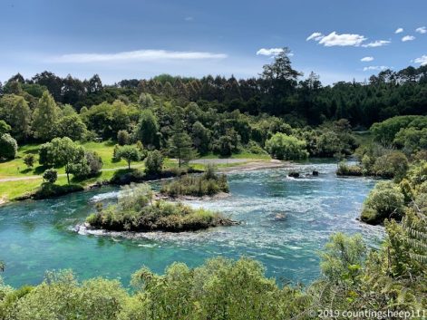
Waikato river
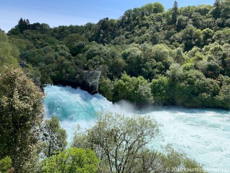
Huka falls
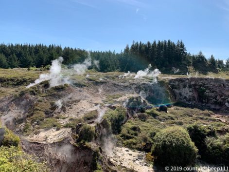
Craters of the moon
20.11.2019 – Rotorua
Today was some more sightseeing in Rotorua: in the morning I have visited Te Puia geothermal valley and center for Māori culture. Was interesting to see some erupting geysers and bubbling mud. Not sure whether it’s totally worth the entrance fee though ;). Afterwards was some hiking. Did catch an Uber to reach the trail head for the Jubilee Track leading up Mt Ngongotaha. Took about 45min to reach the summit. Summit view was two large antennas ;). But that was expected. On the way down were some nice views on lake Rotorua. I was somewhat surprised to not meet any other hikers up there as most people walking around in Rotorua look equipped for some serious mountaineering. But seems they prefer other destinations.
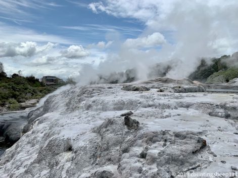
Te Puia
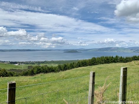
Lake Rotorua
19.11.2019 – Rotorua
Got new shoes *yeah*. Did only take about 30min including a little test walk. Let’s see how the new shoes are performing under real TA conditions in a couple of days ;). Took the bus to Roturua in the afternoon and walked around in Kuirau Park and Government Gardens. It’s somewhat scary to stand directly next to boiling hot bubbling mud with a sulfur smell.
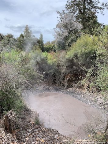
Kuirau Park
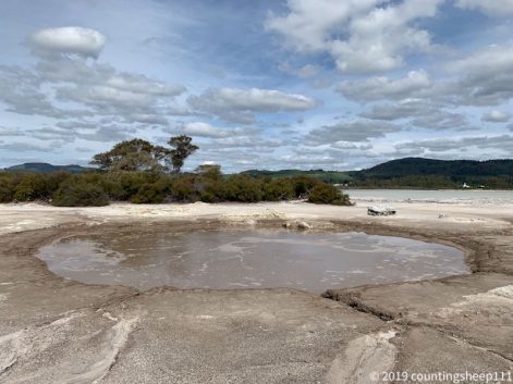
Sulphur Bay
18.11.2019 – Hamilton
Very rainy today in Taumanurui and I had a lazy day. Enjoyed reading a book while sitting in a cafe. Took the bus to Hamilton in the late afternoon. We drove along all the hills and forests I have walked thru the last 9 days. Took only three hours by bus though ;).
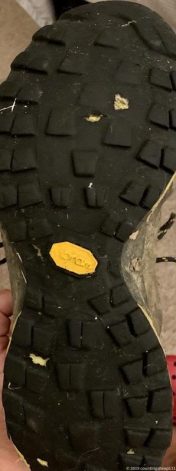
That’s why I need to go and buy new shoes by the way…
17.11.2019 – Rest Day 5
Enjoyed a relaxed start in the day with a properly brewed flat white coffee :). Spent most of the time planning the next days: will go off trail for a bit. First going to Hamilton and hopefully get some new shoes. Afterwards visiting Rotorua and Taupo before going back on trail for the Tongariro crossing and 42nd traverse tracks (north bound).
16.11.2019 – Trail Day 37
Completed the Timber Trail today (and crossed trail km 1000). The last stretch was around 20km. I then left the official TA route and went to the state highway to hitchhike to Taumanurui as I did not want to spend another day of walking on (gravel) roads. Was a bit worried about catching a ride as cars passed by only every couple of minutes. But worked out after about 15 minutes and a young couple picked me up and dropped me off 20km later at Taumarunui. I went for a “luxury” accommodation and checked in at a motel for two nights. Will have to figure out where to get new shoes. And I have also decided to do a bit of cherry picking for the remaining TA sections on the north island. Want to avoid road walking and might go off trail to explore some other areas.
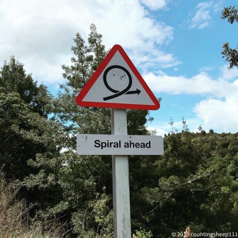
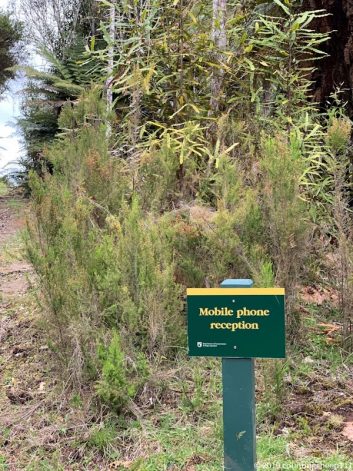
15.11.2019 – Trail Day 36
After 25km of easy walking I have arrived at No 10 campsite of the Timber Trail around 3.30. The day started with rain again, but meanwhile it is sunny and the tent is dry again. Seems I am the only one stopping at this campsite. All other TA hikers that were around yesterday are probably doing a 45km day. It is quite idyllic here and I prefer having a relaxing afternoon over doing yet another long day. I did not come here to win a race ;). Highlight of the day (besides nice forest scenery) the longest suspension bridge on the Timber Trail with 141m length and 53m above ground. Other than that my shoes are about to die. The rubber sole has some holes already… looks like I need to go shopping ;).
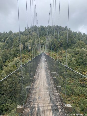
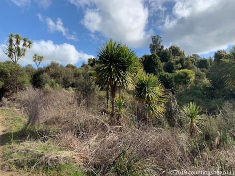
14.11.2019 – Trail Day 35
This morning I was quite happy to carry a two person tent. It was raining heavily but I had enough room for cooking breakfast and packing my backpack without having to leave the tent. Around eight I then started with the first section of the Timber Trail, a very nice path leading thru Pureora forest. It is also bikeable and thus quite an easy walk. That’s probably why today was a 40km day, longest distance so far I think. Went pretty well and took around 9.5hrs to reach Piropiro campsite. Highlights of the timber trail are a couple of big suspension bridges. Feels a bit like riding a roller coaster when there is some wind. The rain luckily stopped in the afternoon and the tent could dry up a bit. But I think more rain to come tomorrow…
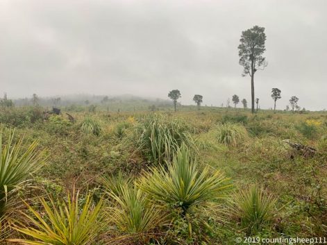
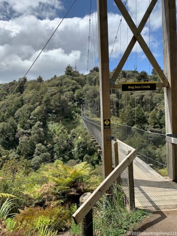
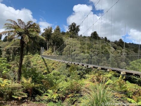
13.11.2019 – Trail Day 34
Last night was the first quite cold night. I had to close my sleeping bag tightly and slept really well. Today was 37km of walking, mostly on gravel roads, until reaching Pureora Forest Campground. Went quite well and again very nice views. The area itself is quite remote, no cell phone coverage and no shops. Mostly farms all over the place and this means many cows and sheep walking between green hills. Currently enjoying couscous and tuna for dinner before crawling into the sleeping bag.
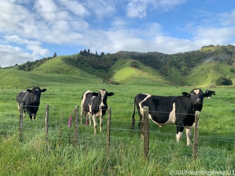
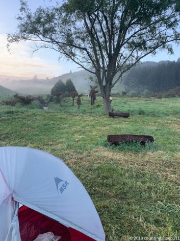
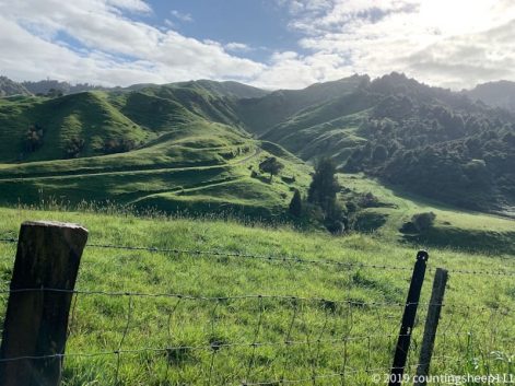
12.11.2019 – Trail Day 33
The 20km today were a bit harder than expected. Lots of up and down along the river with slippery sections, thorny sections, and steep sections. At one point the TA marker just pointed straight up the hill, no path visible at all. But the views along the way were totally worth it. Really feels like being in middle earth now, just hobbits are missing. Camping is at a nice little camp ground totally of grid. We are surrounded by sheep, probably need to go for ear plugs tonight…
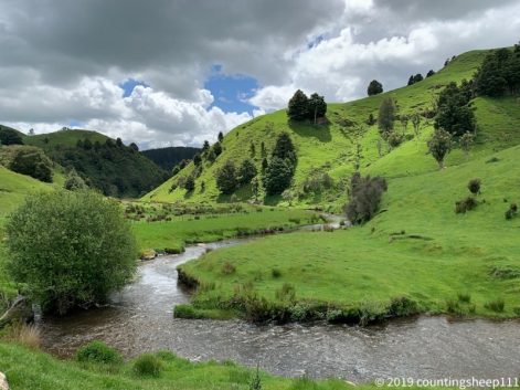
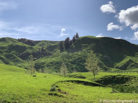
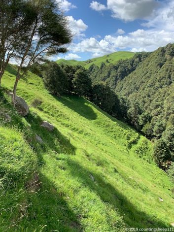
TA marker at the bottom just pointing uphill.
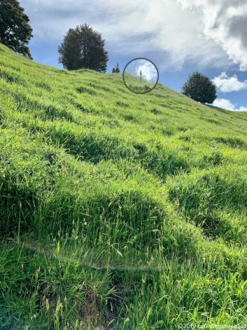
Just find your way up…
11.11.2019 – Trail Day 32
Today was a 15km hike from Waitomo to Te Kuiti (no rain!). First section was two quite slippery hills with some nasty thorny plants, but afterwards a nice track across farmland with lots of stiles for crossing fences. And a little suspension bridge which was fun. Arrived at Te Kuiti around 3pm and have time for some laundry and resupply for the next section. Will be about 6 days to Taumarunui.
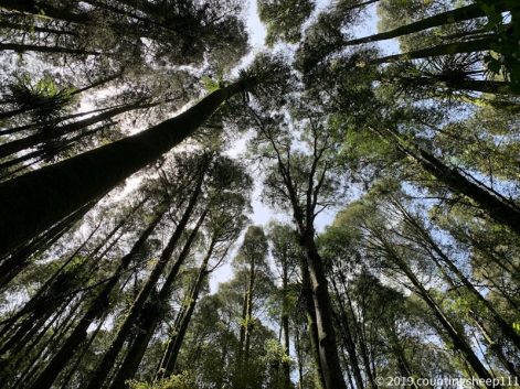
Forest section
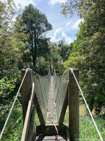
River crossing
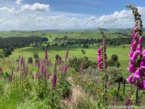
10.11.2019 – Trail Day 31
Started into to day with clouds all around and slight rain. Was about time after many sunny days ;). Thus, the descent towards Waitomo was quite muddy and slippery. And literally walking in the clouds. But still enjoyed it :). And used my rain pants for the first time ;). The trail also included the first real river crossing. I was somewhat concerned whether the rain would make the crossing difficult but the river was quite calm. About knee deep for the first two meters, then a couple of meters ankle deep water. This resulted in very clean shows. But lasted only for about 10 minutes until the next muddy section started. Sun came out for 2hrs in the afternoon but right before hitting Waitomo village heavy rain started and I got soaked. Nevertheless went to go for some touristic sightseeing and visited Waitomo glowworms cave – a very unique and spectacular experience when thousands of bluish glowing worms shed light into the darkness of the cave. Overall about 22km of walking on trail and a bit additionally for reaching YHA Waitomo.
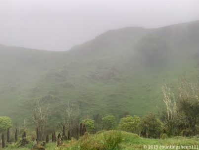
There is also clouds and rain here…
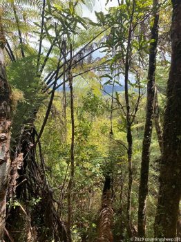
And then again sun…
09.11.2019 – Trail Day 30
First time camping in the wild, between nice green hills, sheep, and horses :). Today was 29km of walking. Early start at the hut and 3hrs of descending with some mud hopping included. But a very nice trail. Afterwards was gravel road walking and farm land with some amazing views. Last section was muddy bush track again. Right after leaving the jungle, a nice area showed up with some decently flat spots to pitch a tent.
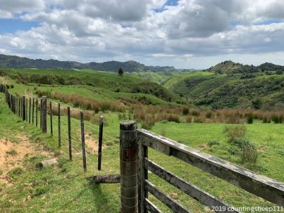
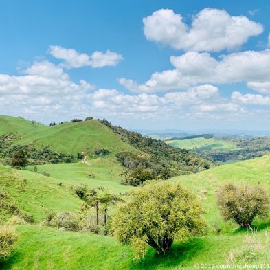
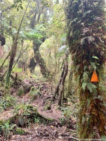
Pirongia Forest Magic Scenery
08.11.2019 – Trail Day 29
Today is the first day/night I am staying at a DOC hut – Pahautea Hut. Got the one year DOC backcountry but pass beginning of October when I have arrived here and above hut is the first one I am using it for to stay for free. The hut is really nice and provides some great views. The walk up here to Pirongia was not as hard and muddy as expected and we arrived at the hut at around 3pm after only 8km and 900m ascent. But it’s really worth staying here to relax a bit. The walk itself led through some very scenic forest and was pretty easy to follow.
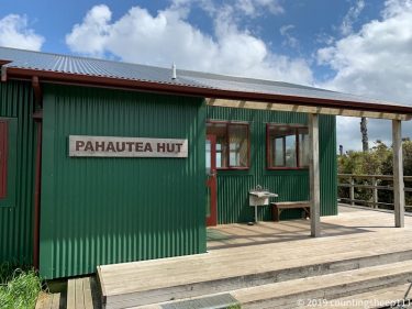
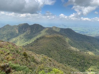
Pirongia forest
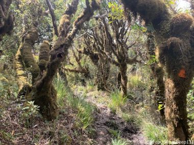
07.11.2019 – Trail Day 28
Today was a “normal” trail day. Started with a proper breakfast at Whatawhata and then hit the trail. First part was going along a river but was more crawling thru bushes than walking. And searching for ways to avoid crossing farm land with 30+ young cows on it. They seemed to find walkers interesting and wanted to play. I didn’t. Afterwards was some road walking before the trail climbed up into hills. Felt like hiking in the alps. Many sheep and lambs around and some more cows and views on green hills – just beautiful. Shortly before reaching the camp I took a swim in Kaniwhaniwha Stream. Now the tent is pitched at Kaniwhaniwha campsite, a very idyllic place. Overall about 25km walking with about 600m ascent.
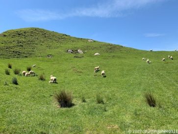
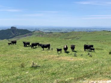
06.11.2019 – Trail Day 27
Started the day with a 2hrs bus ride to skip the Auckland-Hamilton section of the trail. Walked to Whatawhata from Hamilton, about 15km. Some farmland and some nice views on the mountains I will be hiking through the next few days. And a nice section through Taitua Arboretum. Pitched the tent in the backyard of an eatery which has a special tonight sirloin steak and beer for 20NZD – what a coincidence ;). But before actually enjoying dinner I had to head back to Hamilton. One of my poles lost its tip and I had to replace the poles. Could hitchhike to Hamilton and get some new poles. Got an Uber to get back to Whatawhata. Luckily the whole detour took only about 1.5 hrs.
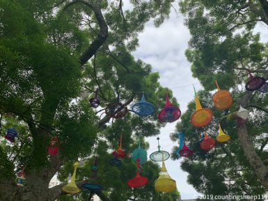
Hamilton City Center
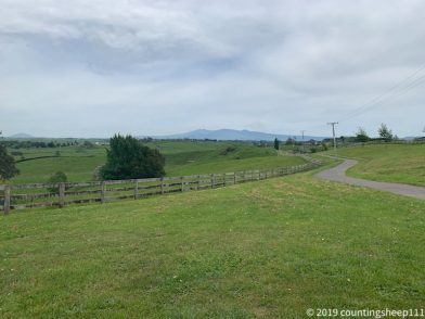
Lunch break with a view on the mountains part of the next trail section.
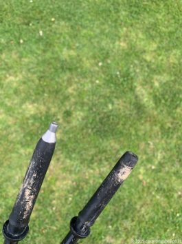
05.11.2019 – Trail Day 26
Well, today was not quite a trail day ;). First of all, it started with a proper breakfast and flat white coffee. I am staying for two nights at the YHA Auckland International and did the Auckland coast to coast walk today, a ~12km stretch also part of the TA. Took the bus back to the YHA afterwards and went shopping in the afternoon. Did get new socks (climbing thru jungle put a hole in one of the old socks), a new waterproof phone bag and food for the next stretch. The walk went over Mount Eden with some nice views on Auckland and the surroundings. Also went up One Tree Hill, but this was not too exciting. Had again a real lunch (BLAT sandwich, bacon-lettuce-avocado-tomato) and a raspberry white chocolate muffin for dessert.
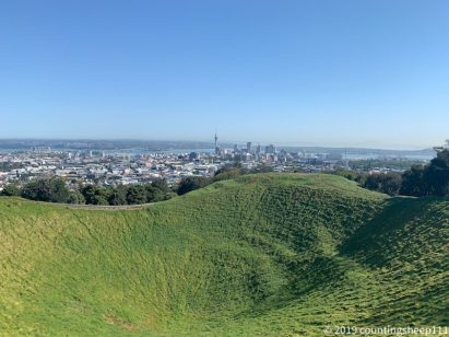
Mount Eden
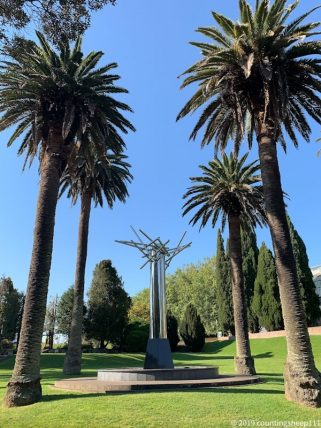
I think it’s supposed to be art…
04.11.2019 – Trail Day 25
Compared to yesterday’s walk today was pretty boring. Nevertheless the trail led along some beaches and contained nice stretches of coastal walks. So overall a quite relaxing 22km day. Highlight was having a real lunch (Salmon Bagel) along with a smoothie. So yummy :). Also nice was the stop at Devonport North Head with a nice view on Auckland downtown. This is where the journey had begun. Took one day by bus to go up north and 25 days of walking to come back. But it feels good :). Took the ferry to cross the harbour and walked to the YHA to enjoy another proper meal in the evening.
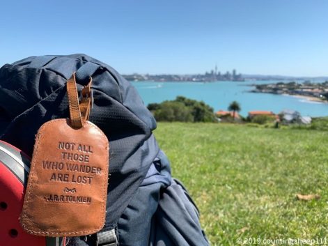
Auckland from North Head
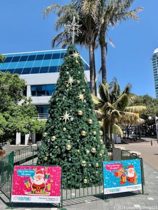
X-mas is coming
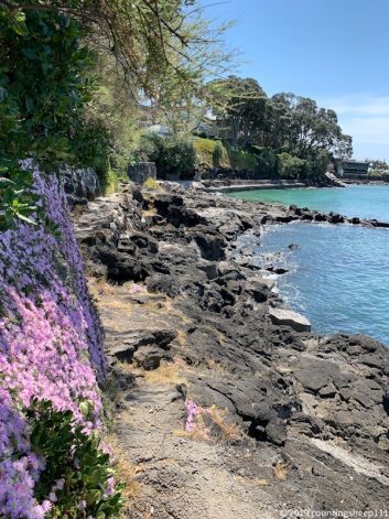
03.11.2019 – Trail Day 24
Although there are now cities all around today was quite an adventure. First half was street walking on a road you better should not walk: lots of narrow curves and no shoulder to walk on. Luckily it was Sunday morning with not a lot of traffic. As a lunch spot I identified a little cafe at the beach. Nice plan, but was not open. At least they offered some water ;). Second part of the day started with a nice bush track along the coast (Okura Track). It was necessary to cross an estuary. The TA route only works at low tide being at around 8pm. Thus I took the alternative route with a supposedly good place to cross at high tide. Did not work. I ended up in water reaching up to my chest (the dry back in my backpack keeps things really dry 😉 ) and then decided to go for the alternative without a crossing required. Unfortunately it was not clearly stated somewhere that this whole track is closed due to kauri dieback disease. So I ended up in front of a wooden door blocking the bridge at the very end of the track. Did not want to go back so climbed down into very muddy mangroves and made my way through knee deep mud and waist deep water. Can not quite recommend. After another hour of road walking and a short stop to remove some mud I made it to Browns Bay where I am staying at an Airbnb place. Took another 1.5 hours to get things cleaned up. So long day, about 30km walking and very muddy.
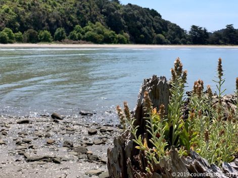
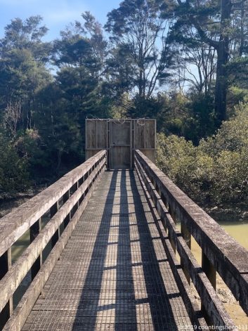
Trail closed – at the very end…
02.11.2019 – Trail Day 23
Today was a lazy start in the day with some specials for breakfast. The owner of the Airbnb place provided some eggs (chicken were walking around the house) and goat milk. Both are very tasty :). Afterward we were kayaking 8km from Puhoi to Wenderholm leaving around noon with the outgoing tide. Very relaxing after two long days of walking. From there the trail went up a little hill and over rocks along the beach. Quite some scrambling was involved. Last two kilometers was then classical beach walking. So overall 8km kayaking plus 10km walking.
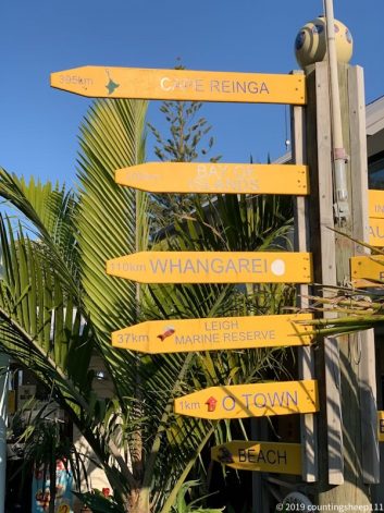
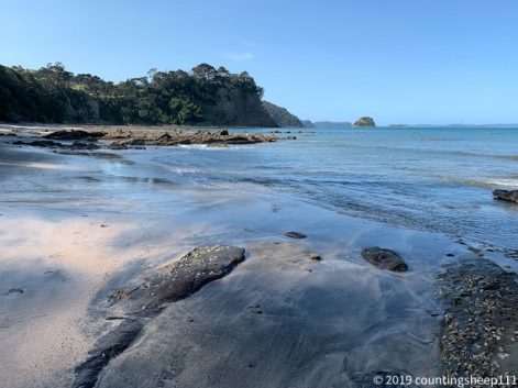
01.11.2019 – Trail Day 22
After hitchhiking back to where we left the trail yesterday we started walking again. Destination of today is Puhoi where a pub is located conveniently at the end of the walking track. Dinner was fish and chips, nachos with salsa and ice cream. Quite fascinating how much one can eat after walking 29km with a heavy backpack :-D. The tracks today were really nice. A bit of bush track, farm tracks and forestry roads. Not overly difficult but nevertheless climbing about 800m in total. Also notable: first day without taping feet and no new blisters!!! And passed the 500km mark :-).
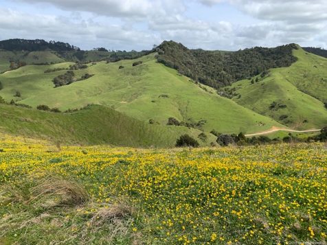
31.10.2019 – Trail Day 21
Looong day, walking for 11hrs from Pakiri to Dome Valley with two peaks in between Tamahunga Peak (437m) and The Dome (336m). Lots of uphill and downhill but a very nice trail mostly through forests. And mostly not muddy! Besides being really tired everything is fine. Hitchhiked two kilometers off trail to a little holiday park. Walking distance was 27km.
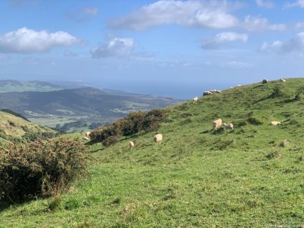
30.10.2019 – Trail Day 20
Went from Mangawhai Heads to Pakiri where we are staying at a nice holiday park. First part today was road walking before hitting the beach for about 15km. There was Te Arai point halfway through: a little hill and bush climbing and some nice scenery. About 27km walking today.
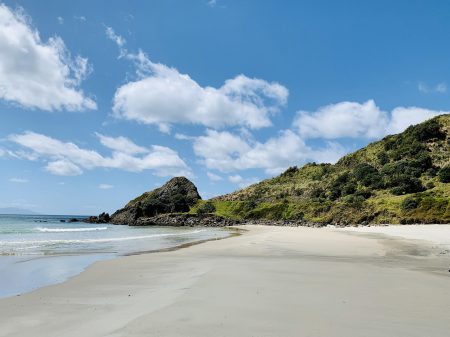
29.10.2019 – Rest Day 4
Got resupplies for the next couple of days. Guess dinner will be couscous with dried peas and tuna mostly ;). But some variations for lunch are upcoming: got Nutella instead of peanut butter.
28.10.2019 – Trail Day 19
Made it to Mangawhai Heads today from Waipu Cove, about 25km. This walk had a bit of everything: nice views, road, jungle track, beach. Now staying at a nice little backpackers with a rest day planned for tomorrow. I do not feel too exhausted after the last few days, but I’m looking forward to relaxing a bit and doing a proper resupply and laundry ;).
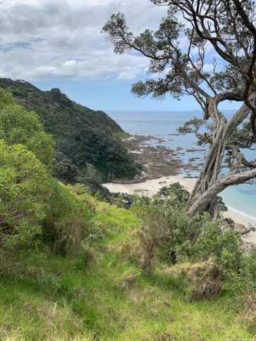
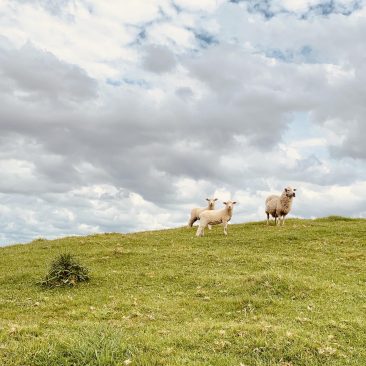
27.10.2019 – Trail Day 18
Walked from Ocean Beach to Whangarei Harbour and crossed with a boat. Continued (after a little detour on the wrong side of a fence inside the oil refinery) to Waipu. Overall about 30km of walking. Got then offers a ride from Waipu to Waipu Cove which I have happily accepted to skip another 7km of road walking. Now sitting at the beach and enjoying one of the first summer days in New Zealand.
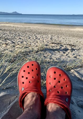
26.10.2019 – Trail Day 17
Yeah – beach walking again. But only a 1.5hrs stretch down Ocean Beach. Overall a short day full of sun. About 13km “only”, but feels good to actually have some time for a coffee in the afternoon and reading a bit the trail notes.
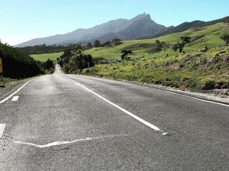
25.10.2019 – Trail Day 16
Two river / sea crossings successfully accomplished 🙂 (crossing Horahora and Taiharuru rivers). Was not a very long day and we made it to a little campsite a bit of the trail. Overall about 20km.
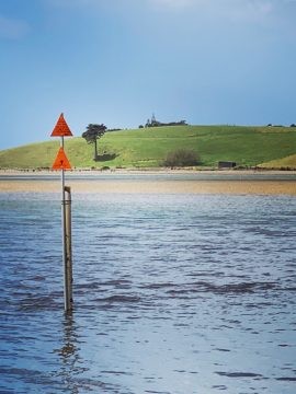
24.10.2019 – Trail Day 15
Very scenic walk from Whananaki to Ngunguru. At the beginning we crossed the supposedly longest footbridge in the southern hemisphere. Lunch stop at Matapouri with fish and chips and a milkshake. So yummy and no need for cereal bars in the afternoon. At Ngunguru we took a little boat to a beautiful camp side. Met our little trail family again here who took a rest test. Baked beans and avocado cream cheese wraps for dinner. Amazing!
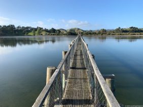
23.10.2019 – Trail Day 14
Long day with two connected tracks which brought us to Whananaki. Although just 24km it took around ten hours. Lots of uphill and downhill walking through forests. Amazing views on the coastline. And luckily only little rains, which means almost no mud. Tonight I’m staying at Whananaki holiday park.
Also: made it across trail km 300 and seems like no new blisters (on the feet, got one on the hand though due to using poles for climbing uphill).
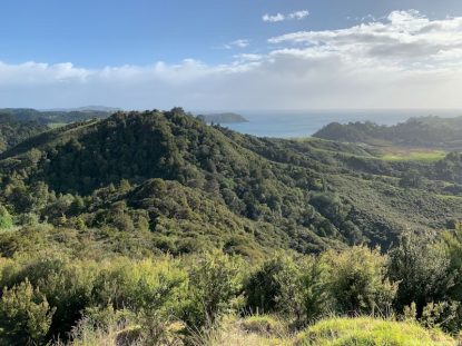
22.10.2019 – Trail Day 13
Today was Russell Forest track. Once I figured out the trail does neither go right nor left of the river, but the trail is the river, it was a fun day. Felt like jungle trekking, well – it actually was jungle trekking. Made it to Helena Bay – overall 28km with lots of road walking after the forest :(. Got offered a great place to pitch the tent at Helena Bay. And it is absolutely beautiful here.
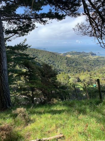
Russel Forest track
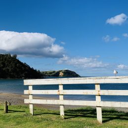
Helena Bay
21.10.2019 – Trail Day 12
Kayaking for 3.5hrs from Paihia to Waikare. Was fun and a nice change compared to walking all day. Camped at Sheryl‘s place in the early afternoon and had a very relaxing evening meeting again the New Zealand couple we had lost at Apple Dam camp.
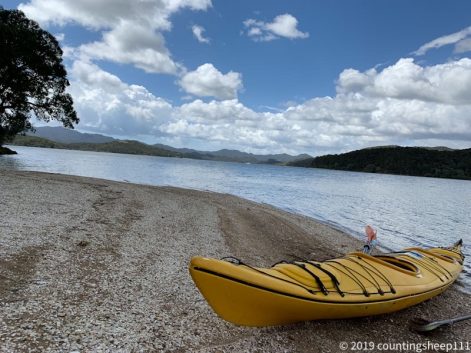
20.10.2019 – Trail Day 11
Made it to the east coast :). It was about 28km today to get from Kerikeri to Paihia with mainly walking on gravel roads through the forest. Blisters still do somewhat bug me. But tomorrow will be a day of kayaking, so no walking.
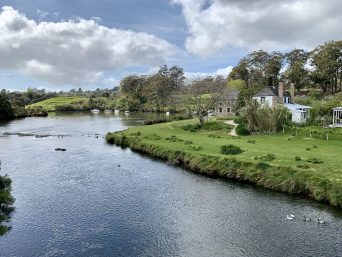
Stone Store Kerikeri
19.10.2019 – Rest Day 3
Got resupplies and did not do much else.
18.10.2919 – Rest Day 2
Mainly blister treatment ;-). Decided to do another rest day tomorrow as well and also want to send some gear ahead to Wellington. Had a great burger for dinner with parts of our little trail family.
17.10.2019 – Trail Day 10
Yeah! Crossed the 200km point today on the way to Kerikeri. It was a very scenic walk for the first time seeing some sheep. And some unintentional river crossings since we missed the trail by a couple of hundred meters. Getting back on track took us through some streams and swamps. Last kilometers went along Kerikeri river and we passed rainbow waterfalls. Unfortunately the blister situation became worse. So rest day tomorrow at Kerikeri.
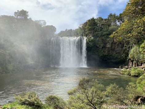
Rainbow Falls
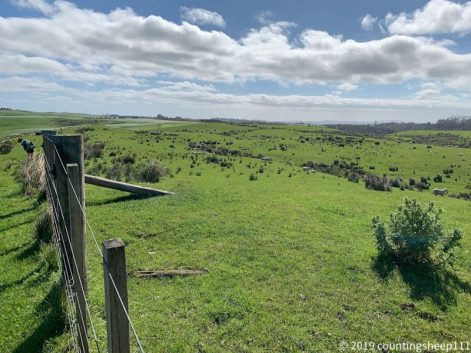
16.10.2019 – Trail Day 9
35km of walking, should be enough for a day. Took a different route than suggested due to rain which would have made river crossings dangerous. And I have decided against hiking in wet clothes and used short pants instead. Was only raining a few times today, sooo all worked out. Saw the first Kauri trees today and we are now staying for the first time at a hut at Puketi Forest, good choice as alternative would have been building up the wet tent again.
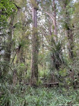
Kauri trees
15.10.2019 – Trail Day 8
We made it to the Apple Dam Camp side today, was only a short section of 12 km. Had some heavy rain during the walk but weather cleared up now. Nevertheless – tomorrow will be hiking in wet pants. Due to the heavy rain we might have to choose a detour to prevent some river crossings.
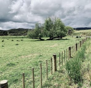
14.10.2019 – Trail Day 7
Mud. Mud. More mud. And rain. Made it thru Raetea Forest and got offered a dry room (old caravan) next to a dairy. We need to wait out some bad weather and have a short walk planned for tomorrow to the next camp.
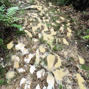
13.10.2019 – Trail Day 6
After hitchhiking to the start of the next section we made it up Raetea summit by following the Raetea Forest Track. This means mud, more mud and about 1.5 km/h progress. At the top there is a great place to camp with quite a view. Tomorrow will be an early start to avoid heavy rain and winds – let’s see how this plan goes.
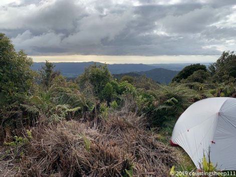
12.10.2019 – Rest Day 1
Getting ready for the next section.

11.10.2019 – Trail Day 5
First day of road walking from Ahipara to Kaitaia. Actually not too much fun… ;-). And in the end the whole trail family arrived at the Beachcombers in Kaitaia. Many TA walkers stick around here. Tomorrow will be a zero day for me with getting supplies. Besides my feet covered with blisters I am doing better than expected and looking forward to eating some burger or so tonight.
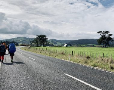
10.10.2019 – Trail Day 4
Yeah – made it to Ahipara. Another 30km stretch and now enjoying warm showers at the YHA. And taking care of blisters (stopped counting them 😉 ).
09.10.2019 – Trail Day 3
Another day walking at the beach. A quite monotonous activity (resulting in more blisters btw 😉 ). Now the tent is pitched at Utea Park Campsite and a simple thing like eating just feels great after 28km walking.
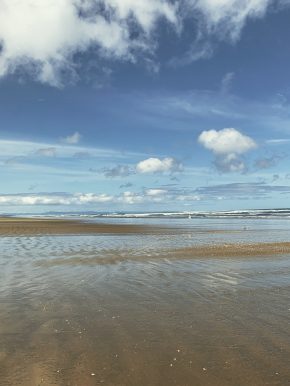
Beach 😉
08.10.2019 – Trail Day 2
Great walking day again, but with 28km somewhat exhausting. 25km was beach walking resulting in about three blisters. There will be some tape needed tomorrow… ;). Now pitched the tent at Bluff Campsite with ocean waves as background noise. Quite relaxing.
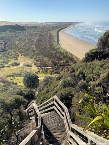
Part of 90 Mile Beach. This part we walked today.
07.10.2019 – Trail Day 1
A great walking day. Sunny, amazing views and nothing to complain about. Arrived at the Twilight beach camp after about 4hrs of walking.
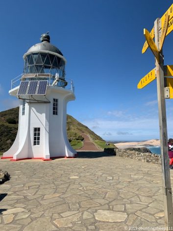
Cape Reinga
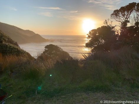
Twilight beach camp
07.10.2019 – Before Trail Day 1
River safety course was a great experience. It included crossing a river in a group, alone with a pole and getting washed away while using the backpack as a floating device. A bit cold though. Yesterday we took a bus to Kaitaia and today walking will start. Will be leaving Kaitaia at 9, heading to Cape Reinga and then starting with the first 12 km to Twilight beach camp. Exciting times!!! Will most probably be offline for the next few days. But my position should be tracked.
04.10.2019
Now it’s only three days left until I will start the adventure of hiking Te Araroa. I am currently in Auckland – looong flight to get there… – and getting supplies for the first couple of days. Next thing is the river safety course tomorrow.
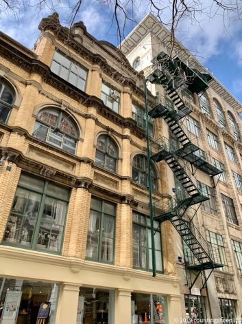
Auckland City